Difference between revisions of "2011-08-04 48 10"
From Geohashing
imported>Ordnungswidrig (→Achievements) |
imported>Ordnungswidrig (→Photos: fix coordinates) |
||
| Line 45: | Line 45: | ||
<gallery perrow="5"> | <gallery perrow="5"> | ||
| − | Image:2011-08-04_48_10_18-55-21-921.jpg | Lonely in the sunshine... [http://www.openstreetmap.org/?lat=48 | + | Image:2011-08-04_48_10_18-55-21-921.jpg | Lonely in the sunshine... [http://www.openstreetmap.org/?lat=48.4789&lon=10.0065&zoom=16&layers=B000FTF @48.4789,10.0065] |
</gallery> | </gallery> | ||
Revision as of 07:53, 5 August 2011
| Thu 4 Aug 2011 in 48,10: 48.4789413, 10.0065033 geohashing.info google osm bing/os kml crox |
Location
Hayfield near Hörvelsingen
Participants
- Ordnungswidrig - first hash
Plans
Unknown
Expedition
Looks like someone made it there, based on the coords on the picture.
Parked near the location next to the forest. 5 min footwalk on the hayfield. Biggest obstacle was the loss of cell phone connection. No other hash met.
Tracklog
Photos
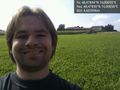
Lonely in the sunshine... @48.4789,10.0065

Achievements
ordnungswidrig earned the Land geohash achievement
|