Difference between revisions of "2011-08-04 48 10"
From Geohashing
imported>Ordnungswidrig (→Photos: fix coordinates) |
imported>Ordnungswidrig m |
||
| Line 26: | Line 26: | ||
== Plans == | == Plans == | ||
<!-- what were the original plans --> | <!-- what were the original plans --> | ||
| − | + | No plan, go and get the hash. | |
| − | |||
== Expedition == | == Expedition == | ||
| Line 35: | Line 34: | ||
Parked near the location next to the forest. 5 min footwalk on the hayfield. Biggest obstacle was the loss of cell phone connection. No other hash met. | Parked near the location next to the forest. 5 min footwalk on the hayfield. Biggest obstacle was the loss of cell phone connection. No other hash met. | ||
| − | |||
| − | |||
| − | |||
== Photos == | == Photos == | ||
Revision as of 07:59, 5 August 2011
| Thu 4 Aug 2011 in 48,10: 48.4789413, 10.0065033 geohashing.info google osm bing/os kml crox |
Location
Hayfield near Hörvelsingen
Participants
- Ordnungswidrig - first hash
Plans
No plan, go and get the hash.
Expedition
Looks like someone made it there, based on the coords on the picture.
Parked near the location next to the forest. 5 min footwalk on the hayfield. Biggest obstacle was the loss of cell phone connection. No other hash met.
Photos
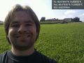
Lonely in the sunshine... @48.4789,10.0065

Achievements
ordnungswidrig earned the Land geohash achievement
|