Difference between revisions of "2011-09-13 53 -1"
From Geohashing
imported>Monty (→Plans: Mis-markedup.) |
imported>Monty m (Getting the photos up first, for once.) |
||
| Line 9: | Line 9: | ||
== Location == | == Location == | ||
Just above Langsett Reservoir (up Calf Knoll Brook) on the side of Midhope Moors. | Just above Langsett Reservoir (up Calf Knoll Brook) on the side of Midhope Moors. | ||
| − | |||
== Participants == | == Participants == | ||
| Line 15: | Line 14: | ||
== Plans == | == Plans == | ||
| − | ''Possibly'' first thing in the morning, but probably after work. Nights are drawing in, so we'll have to make sure I'm not stuck at work longer than | + | ''Possibly'' first thing in the morning, but probably after work. Nights are drawing in, so we'll have to make sure I'm not stuck at work longer than necessary. |
== Expedition == | == Expedition == | ||
| − | |||
| − | |||
== Tracklog == | == Tracklog == | ||
| Line 30: | Line 27: | ||
--> | --> | ||
<gallery perrow="5"> | <gallery perrow="5"> | ||
| + | Image:20110913_53-1_01_StartTheWalk.png | Setting off on foot. | ||
| + | Image:20110913_53-1_02_PathChoice.png | When one gate closes, another opens | ||
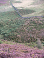
| + | Image:20110913_53-1_03_Locality.png | A visual guide | ||
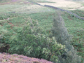
| + | Image:20110913_53-1_04_ThickwoodsBrook1.png | Departing from the trail | ||
| + | Image:20110913_53-1_05_ThickwoodsBrook2.png | Head towards the light! | ||
| + | Image:20110913_53-1_06_ThickwoodsBrook3.png | Slow progress | ||
| + | Image:20110913_53-1_07_ThickwoodsBrook4.png | From out of the shadows | ||
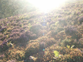
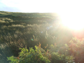
| + | Image:20110913_53-1_08_IntoTheWindAndTheSun(a).png | Blindin' (1) | ||
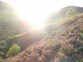
| + | Image:20110913_53-1_09_IntoTheWindAndTheSun(b).png | Blindin' (2) | ||
| + | Image:20110913_53-1_10_IntoTheWindAndTheSun(c).png | Blindin' (3) | ||
| + | Image:20110913_53-1_11_DownTheSlope.png | Down the hillside | ||
| + | Image:20110913_53-1_12_Breezy Treez.png | It was Windy (or was it Tuesday?) | ||
| + | Image:20110913_53-1_13_PrimePoint.png | There I am | ||
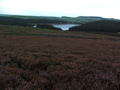
| + | Image:20110913_53-1_14_ABrightOutlook.png | As arty as I could | ||
| + | Image:20110913_53-1_15_TheWayHome.png | Returning in shadow | ||
</gallery> | </gallery> | ||
| Line 37: | Line 49: | ||
| − | |||
| − | |||
| − | |||
[[Category:Expeditions]] | [[Category:Expeditions]] | ||
| − | |||
[[Category:Expeditions with photos]] | [[Category:Expeditions with photos]] | ||
| − | |||
[[Category:Expedition without GPS]] | [[Category:Expedition without GPS]] | ||
| − | |||
| − | |||
| − | |||
[[Category:Coordinates reached]] | [[Category:Coordinates reached]] | ||
| − | |||
| − | |||
| − | |||
| − | |||
| − | |||
| − | |||
| − | |||
| − | |||
| − | |||
| − | |||
Revision as of 16:57, 15 September 2011
| Tue 13 Sep 2011 in 53,-1: 53.4861100, -1.6918199 geohashing.info google osm bing/os kml crox |
Location
Just above Langsett Reservoir (up Calf Knoll Brook) on the side of Midhope Moors.
Participants
Monty to see if he can get there.
Plans
Possibly first thing in the morning, but probably after work. Nights are drawing in, so we'll have to make sure I'm not stuck at work longer than necessary.
Expedition
Tracklog
No tracklog.
Photos
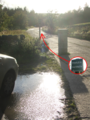
Setting off on foot.
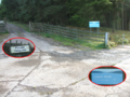
When one gate closes, another opens
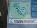
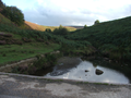
A visual guide
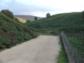
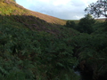
Departing from the trail
Head towards the light!
Slow progress
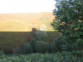
From out of the shadows
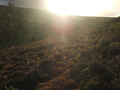
Blindin' (1)
Blindin' (2)
Blindin' (3)
Down the hillside
It was Windy (or was it Tuesday?)
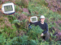
There I am
As arty as I could
Returning in shadow


.png)
.png)
.png)


