Difference between revisions of "2012-05-13 38 23"
From Geohashing
imported>Jonas.gbl (→Photos) |
imported>Jonas.gbl (→Photos) |
||
| Line 34: | Line 34: | ||
File:2012-05-13_38_23_p1.jpg | Stupid Grin | File:2012-05-13_38_23_p1.jpg | Stupid Grin | ||
File:2012-05-13_38_23_p3.jpg | Cycling Proof | File:2012-05-13_38_23_p3.jpg | Cycling Proof | ||
| − | File:2012-05-13_38_23_p4.jpg | My little humble | + | File:2012-05-13_38_23_p4.jpg | My little humble pic nic |
File:2012-05-13_38_23_p5.jpg | The geoHash area | File:2012-05-13_38_23_p5.jpg | The geoHash area | ||
</gallery> | </gallery> | ||
Revision as of 07:01, 14 May 2012
| Sun 13 May 2012 in 38,23: 38.8654550, 23.2888676 geohashing.info google osm bing/os kml crox |
Location
A 10-minutes walk down the river from the waterfall park in Drymwnas, Greece
Participants
Plans
Nothing really to plan! For 2nd consecutive time the geohash spot was just a couple of meters away from one of my cycling roots.
Expedition
Expedition was quite smooth.Cycled 26 km and I was almost there. I just had to walk a couple of meters to the river bank. Some issues finding the actual spot. Limited GPS accuracy, lots of trees.
Tracklog
Photos
All photos are GPS-tagged, as a proof of being there at the correct place & date. For some reason Lat/Lon are not shown on the MetaData table. Just download the files to see the coordinates with an external application such as ACDSee.
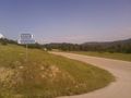
On the way to the geoHash spot

Stupid Grin
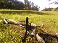
Cycling Proof

My little humble pic nic
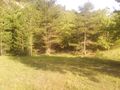
The geoHash area


Achievements