Difference between revisions of "2012-07-27 59 12"
imported>Jiml m (Adjust result codes) |
imported>Cjk |
||
| Line 1: | Line 1: | ||
| − | |||
| − | [[Image:{{{image| | + | [[Image:{{{image|2012-07-27_59_12_19-58-49-086.jpg}}}|thumb|left]] |
| − | |||
| − | |||
| − | |||
| − | |||
{{meetup graticule | {{meetup graticule | ||
| lat=59 | | lat=59 | ||
| Line 18: | Line 13: | ||
== Location == | == Location == | ||
| − | + | In the middle of nowhere, off the E18 towards Oslo, 450 meters a from logging road, beyond a swamp. | |
== Participants == | == Participants == | ||
<!-- who attended: If you link to your wiki user name in this section, your expedition will be picked up by the various statistics generated for geohashing. You may use three tildes ~ as a shortcut to automatically insert the user signature of the account you are editing with. | <!-- who attended: If you link to your wiki user name in this section, your expedition will be picked up by the various statistics generated for geohashing. You may use three tildes ~ as a shortcut to automatically insert the user signature of the account you are editing with. | ||
--> | --> | ||
| + | [[User:Cjk|Cjk]] | ||
== Plans == | == Plans == | ||
<!-- what were the original plans --> | <!-- what were the original plans --> | ||
| + | I was already driving from Stockholm to Fiskebäckskil so why not take a detour and geohash along the way. If I go north of the largest lake in Sweden, Vänern I could deflower a Virgin Graticule. | ||
== Expedition == | == Expedition == | ||
<!-- how it all turned out. your narrative goes here. --> | <!-- how it all turned out. your narrative goes here. --> | ||
| + | Packed the car and drove out from Stockholm, turned towards Örebro in Södertälje, and towards Karlstad in Örebro. A lot of vacation traffic with motor homes and caravans. Got some burgers in Karlstad. | ||
| + | *In Karlstad -- [[User:Cjk|Cjk]] [http://www.openstreetmap.org/?lat=59.38341503&lon=13.47624304&zoom=16&layers=B000FTF @59.3834,13.4762] 18:46, 27 July 2012 (CEST) | ||
| − | + | Continued on the E18 towards Oslo and got off the "highway" at the right spot, onto a narrow road, then a gravel road and then a logging road. Stopped the car at the mininum distance to the hash. I jumped over a ditch and started making my way through what turned out to be a swamp. I turned back after like 7 m and tried to jump over the ditch to find a dry route around the swamp, but the rotten logs covered in moss gaveme no footing at all and I landed in the ditch with water up to my calves. | |
| + | |||
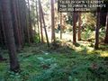
| + | Fuck it, already wet, lets cross this swamp. Hiked up a hill along a logging road and ate some blueberries to get my mind off my soaking Converse. Crossed a few clearings that I had seen on google maps and found the hash which was locaded in a clearing on the side of asmall hill. Snapped some picks and painted the moss. | ||
*Damn swamp, feet wet, deflowered -- [[User:Cjk|Cjk]] [http://www.openstreetmap.org/?lat=59.29106025&lon=12.63000484&zoom=16&layers=B000FTF @59.2911,12.6300] 19:41, 27 July 2012 (CEST) | *Damn swamp, feet wet, deflowered -- [[User:Cjk|Cjk]] [http://www.openstreetmap.org/?lat=59.29106025&lon=12.63000484&zoom=16&layers=B000FTF @59.2911,12.6300] 19:41, 27 July 2012 (CEST) | ||
| + | |||
| + | Started heading back to the car and realized just how wet this "summer" has been in sweden when the moss gave way and I started sliding down the hill. | ||
| + | |||
| + | Ate some common wood-sorrel, or [http://en.wikipedia.org/wiki/Common_wood_sorrel 'harsyra'], on the way back. | ||
| + | |||
| + | Found the dry route I should have taken and got backto my car. Removed shoes and socks and donned pink flip-flops. Headed back to the E45 and drove the rest of the way towards Fiskebäckskil. By the last turn off point a wanker in a SUV headed straight for me in my lane on the wrong side of an aboutment. Total tosser. | ||
| + | |||
== Tracklog == | == Tracklog == | ||
<!-- if your GPS device keeps a log, you may post a link here --> | <!-- if your GPS device keeps a log, you may post a link here --> | ||
| Line 42: | Line 50: | ||
--> | --> | ||
<gallery perrow="5"> | <gallery perrow="5"> | ||
| − | |||
| − | |||
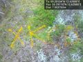
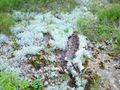
Image:2012-07-27_59_12_19-58-49-086.jpg | Made it, with Campanja T-shirt [http://www.openstreetmap.org/?lat=59.29110000&lon=12.62990000&zoom=16&layers=B000FTF @59.2911,12.6299] | Image:2012-07-27_59_12_19-58-49-086.jpg | Made it, with Campanja T-shirt [http://www.openstreetmap.org/?lat=59.29110000&lon=12.62990000&zoom=16&layers=B000FTF @59.2911,12.6299] | ||
Revision as of 11:49, 29 July 2012

| Fri 27 Jul 2012 in 59,12: 59.2910436, 12.6299855 geohashing.info google osm bing/os kml crox |
Location
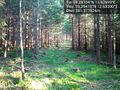
In the middle of nowhere, off the E18 towards Oslo, 450 meters a from logging road, beyond a swamp.
Participants
Plans
I was already driving from Stockholm to Fiskebäckskil so why not take a detour and geohash along the way. If I go north of the largest lake in Sweden, Vänern I could deflower a Virgin Graticule.
Expedition
Packed the car and drove out from Stockholm, turned towards Örebro in Södertälje, and towards Karlstad in Örebro. A lot of vacation traffic with motor homes and caravans. Got some burgers in Karlstad.
- In Karlstad -- Cjk @59.3834,13.4762 18:46, 27 July 2012 (CEST)
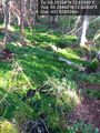
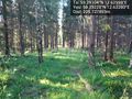
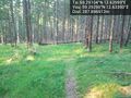
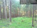
Continued on the E18 towards Oslo and got off the "highway" at the right spot, onto a narrow road, then a gravel road and then a logging road. Stopped the car at the mininum distance to the hash. I jumped over a ditch and started making my way through what turned out to be a swamp. I turned back after like 7 m and tried to jump over the ditch to find a dry route around the swamp, but the rotten logs covered in moss gaveme no footing at all and I landed in the ditch with water up to my calves.
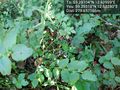
Fuck it, already wet, lets cross this swamp. Hiked up a hill along a logging road and ate some blueberries to get my mind off my soaking Converse. Crossed a few clearings that I had seen on google maps and found the hash which was locaded in a clearing on the side of asmall hill. Snapped some picks and painted the moss.
- Damn swamp, feet wet, deflowered -- Cjk @59.2911,12.6300 19:41, 27 July 2012 (CEST)
Started heading back to the car and realized just how wet this "summer" has been in sweden when the moss gave way and I started sliding down the hill.
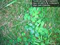
Ate some common wood-sorrel, or 'harsyra', on the way back.
Found the dry route I should have taken and got backto my car. Removed shoes and socks and donned pink flip-flops. Headed back to the E45 and drove the rest of the way towards Fiskebäckskil. By the last turn off point a wanker in a SUV headed straight for me in my lane on the wrong side of an aboutment. Total tosser.
Tracklog
Photos

Made it, with Campanja T-shirt @59.2911,12.6299
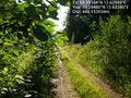
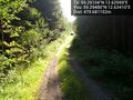
Only 448 m to go from this unknown road @59.2948,12.6328
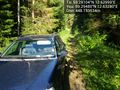
The car in these woods @59.2948,12.6328
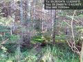
It's in there somewhere @59.2948,12.6328
It was a swamp, tried it, tried to jump back, landed in this ditch and soaked my shoes so wtf, let's just cross this swamp! @59.2946,12.6330
Marsh, swamp, wet feet. @59.2946,12.6330
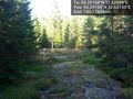
The logging machines have used this path @59.2941,12.6330
Oh look, blueberries!!! Yummy! @59.2931,12.6328
These leaves are my fav, tart and refreshing. 'Harsyra' @59.2927,12.6329
Made it. Marked it with orange(TM) @59.2911,12.6299
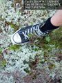
My soaked through converse at the spot @59.2911,12.6299
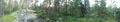
Panorama 1
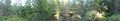
Panorama 2
Wet moss doesn't have the best footing.slipped and almost fell.
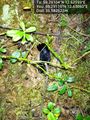
Black slug, not the invading brown murder slug. @59.2911,12.6306
First clearing on the way back @59.2912,12.6309
Second clearing @59.2915,12.6315
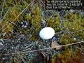
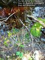
Ooo, an egg. @59.2918,12.6323
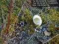
Bugger, already empty @59.2918,12.6323
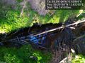
The creek that fills the swamp by the car @59.2918,12.6325
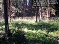
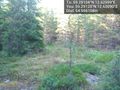
Sparse spruce trees @59.2920,12.6329
The route the logging machines have taken @59.2922,12.6328
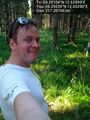
Happy hasher @59.2923,12.6329
Some storm has made its mark @59.2929,12.6335
Getting closer to the car @59.2937,12.6338
This is the way I should have taken to keep my feet dry @59.2945,12.6344
And there's my car @59.2948,12.6341


Achievements
- Land Geohash