Difference between revisions of "2012-08-22 50 11"
From Geohashing
imported>Jens (→Expedition) |
imported>Jens (→Expedition) |
||
| Line 15: | Line 15: | ||
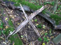
9 km bee-line, that’s just the right distance for a sunny after-work trip – at least for me. Others may think it’s to short. So I cycled to Magdala where I left the road and followed a dirt road that lead directly to the point. Ok, 20 meters beside the point. But even the last 20 meters were easy. Some trees, some brushwood, that’s all. I marked the point with a wooden “X”. Only in case Juja will come here too. Although I told here, that I will go to the point by a chance of 93,2%, so I think she will not try it herself. | 9 km bee-line, that’s just the right distance for a sunny after-work trip – at least for me. Others may think it’s to short. So I cycled to Magdala where I left the road and followed a dirt road that lead directly to the point. Ok, 20 meters beside the point. But even the last 20 meters were easy. Some trees, some brushwood, that’s all. I marked the point with a wooden “X”. Only in case Juja will come here too. Although I told here, that I will go to the point by a chance of 93,2%, so I think she will not try it herself. | ||
| + | |||
| + | == Photos == | ||
| + | {{gallery|width=200|height=200|lines=2 | ||
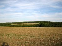
| + | |Image:120822 50 11 01.jpg|View to the point from the distance. | ||
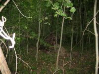
| + | |Image:120822 50 11 02.jpg|The last 20 meters. | ||
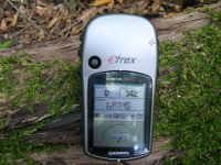
| + | |Image:120822 50 11 03.jpg|Coordinates reached. | ||
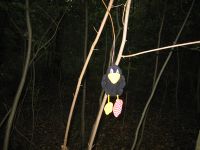
| + | |Image:120822 50 11 04.jpg|Räbe hanging around at the point (notice his stupid grin). | ||
| + | |Image:120822 50 11 05.jpg|The wooden "X". | ||
| + | }} | ||
[[Category:Expeditions]] | [[Category:Expeditions]] | ||
[[Category:Expeditions with photos]] | [[Category:Expeditions with photos]] | ||
[[Category:Coordinates reached]] | [[Category:Coordinates reached]] | ||
Revision as of 19:26, 22 August 2012
| Wed 22 Aug 2012 in 50,11: 50.9114595, 11.4617969 geohashing.info google osm bing/os kml crox |
Location
Forest near Magdala
Participants
- Jens and Räbe
Expedition
9 km bee-line, that’s just the right distance for a sunny after-work trip – at least for me. Others may think it’s to short. So I cycled to Magdala where I left the road and followed a dirt road that lead directly to the point. Ok, 20 meters beside the point. But even the last 20 meters were easy. Some trees, some brushwood, that’s all. I marked the point with a wooden “X”. Only in case Juja will come here too. Although I told here, that I will go to the point by a chance of 93,2%, so I think she will not try it herself.
Photos
|
