Difference between revisions of "2012-10-28 55 37"
From Geohashing
imported>Vb (→Plans) |
imported>Vb (→Photos) |
||
| Line 41: | Line 41: | ||
Image:2012-10-28_55_37_18-38-13-234.jpg | Ministry of finance building. No public access. [http://www.openstreetmap.org/?lat=55.75530000&lon=37.62600000&zoom=16&layers=B000FTF @55.7553,37.6260] | Image:2012-10-28_55_37_18-38-13-234.jpg | Ministry of finance building. No public access. [http://www.openstreetmap.org/?lat=55.75530000&lon=37.62600000&zoom=16&layers=B000FTF @55.7553,37.6260] | ||
| + | |||
| + | Image:2012-10-27 18.35.30.jpg | Long cat is long. | ||
| + | |||
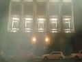
| + | Image:2012-10-27 18.27.44.jpg | Staropanskiy pereulok from Bogoyavlenskiy pereulok. | ||
| + | |||
| + | Image:2012-10-27 18.29.51.jpg | Back sides of the buildings, including the one with the hash. From Bogoyavlenskiy pereulok. | ||
| + | |||
| + | |||
</gallery> | </gallery> | ||
Revision as of 19:17, 27 October 2012
| Sun 28 Oct 2012 in 55,37: 55.7556690, 37.6261149 geohashing.info google osm bing/os kml crox |
Location
Inside the Ministry of Finance building, no public access.
Participants
Plans
vb visited the place on the previous day (actually, evening) and made some photos, which doesn't count as an actual expedition.
Expedition
Tracklog
Photos
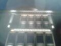
Ministry of finance building. No public access. @55.7553,37.6260
Long cat is long.
Staropanskiy pereulok from Bogoyavlenskiy pereulok.
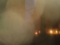
Back sides of the buildings, including the one with the hash. From Bogoyavlenskiy pereulok.


