Difference between revisions of "2013-04-29 40 -105"
From Geohashing
imported>Sylae (Created page with "{{meetup graticule | lat=40 | lon=-105 | date=2013-04-29 }} == Location == A cul-de-sac in Loveland == Participants == *Sylae == Plans == Plan was ...") |
imported>FippeBot m (Location) |
||
| Line 35: | Line 35: | ||
[[Category:Expeditions with photos]] | [[Category:Expeditions with photos]] | ||
[[Category:Coordinates reached]] | [[Category:Coordinates reached]] | ||
| + | {{location|US|CO|LR}} | ||
Latest revision as of 05:52, 6 August 2019
| Mon 29 Apr 2013 in 40,-105: 40.4161675, -105.0492301 geohashing.info google osm bing/os kml crox |
Location
A cul-de-sac in Loveland
Participants
Plans
Plan was to leave Denver via I-25 and take it all the way up to Loveland.
Expedition
All went well, you know you've been in Denver too long when you get excited about a speed limit that isn't idiotically slow. Arrived at the location without trouble, although I opted to not take pictures, since it was late and I didn't want to look like I was scoping houses out to burgle them or something.
Photos
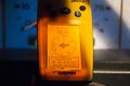
Proof!

Achievements
Sylae (talk) earned the Land geohash achievement
|