Difference between revisions of "2013-05-23 62 23"
imported>FippeBot m (Location) |
m |
||
| Line 38: | Line 38: | ||
[[Category:Expeditions with photos]] | [[Category:Expeditions with photos]] | ||
[[Category:Coordinates not reached]] | [[Category:Coordinates not reached]] | ||
| + | [[Category:Not reached - Mother Nature]] | ||
| + | [[Category:Not reached - Injury]] | ||
{{location|FI|03}} | {{location|FI|03}} | ||
Latest revision as of 11:35, 9 April 2022
| Thu 23 May 2013 in 62,23: 62.5384148, 23.3033634 geohashing.info google osm bing/os kml crox |
Location
In Timanttimaa, Alavus. The point is in forest.
Participants
- Pastori
- The Wife
Expedition
(Today's third hashpoint attempt. The first.)
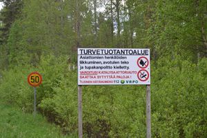
Lapua graticule, town of Alavus, Timanttimaa (translation: Diamond Land). The area was marshland, which was used as a peat production area. We could get nearby with car by using the road circling the area, although we had to disobey a sign forbidding access by unauthorised personnel. Or did we disobey it? In Finnish the word meaning unauthorised literally means "without a cause", and we had a cause! That was geohashing of course!
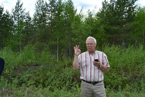
Unfortunately this playing with words didn't help us, because although we could get to about 200 meters from the hashpoint, the point was again located in a thickety forest, and because of the sore leg etc.
In addition we were surprise-attacked by an armada of mosquitoes as soon as we got out of the car. So there was nothing else we could do than to get our bodies back into the car, hold our heads high and head boldly towards new geohashpointdisappointments
( The next day we logged a successful visit to this graticule.)


