Difference between revisions of "2013-06-23 56 -121"
From Geohashing
imported>Wijnland (Created page with "{{subst:Expedition |lat = 56 |lon = -121 |date = 2013-06-23 }}") |
imported>Wijnland |
||
| Line 1: | Line 1: | ||
| − | |||
| − | |||
| − | |||
| − | |||
| − | |||
| − | |||
| − | |||
| − | |||
| − | |||
| − | |||
{{meetup graticule | {{meetup graticule | ||
| lat=56 | | lat=56 | ||
| Line 14: | Line 4: | ||
| date=2013-06-23 | | date=2013-06-23 | ||
}} | }} | ||
| + | |||
| + | [[Image:20130623_56-121_1.jpg | 600px]] | ||
<!-- edit as necessary --> | <!-- edit as necessary --> | ||
__NOTOC__ | __NOTOC__ | ||
== Location == | == Location == | ||
| + | west of the Alaska Hwy just of a forestry road | ||
<!-- where you've surveyed the hash to be --> | <!-- where you've surveyed the hash to be --> | ||
== Participants == | == Participants == | ||
| − | + | * [[User:Wijnland|Wijnland]] ([[User talk:Wijnland|talk]]) | |
| − | + | * Damien | |
| − | == Plans == | + | == Plans\Epedition == |
| − | + | I was on this big trip through the north up to Inuvik and back and wanted to get lots of great hashes, but almost never had internet. I found this hash friday afternoon in TimH in fort st. John. I was travelling with a French Hitchhiker Damien at that point and we camped at the forestry campsite at Inga lake which was great and very nice people there. Sunday morning we set of to get to Ft Nelson that day, but first this geohash. It was somewhat of the highway into the forest, but the forestry road brought us to about 100m from the hash. from there it was an easy find. | |
| − | |||
| − | |||
| − | |||
| − | |||
== Photos == | == Photos == | ||
| − | + | ||
| − | |||
| − | |||
<gallery perrow="5"> | <gallery perrow="5"> | ||
| + | Image:20130623_56-121_2.jpg | GPS proof | ||
| + | Image:20130623_56-121_3.jpg | Pine Canopy | ||
</gallery> | </gallery> | ||
== Achievements == | == Achievements == | ||
{{#vardefine:ribbonwidth|800px}} | {{#vardefine:ribbonwidth|800px}} | ||
| + | {{Virgin graticule | latitude = 56 | longitude = -121 | date = 2013-06-23 | name = Wijnland | image = 20130623_56-121_1.jpg}} | ||
<!-- Add any achievement ribbons you earned below, or remove this section --> | <!-- Add any achievement ribbons you earned below, or remove this section --> | ||
| − | |||
| − | |||
| − | |||
| − | |||
| − | |||
| − | |||
| − | |||
| − | |||
| − | |||
[[Category:Expeditions]] | [[Category:Expeditions]] | ||
| − | |||
[[Category:Expeditions with photos]] | [[Category:Expeditions with photos]] | ||
| − | |||
| − | |||
| − | |||
| − | |||
| − | |||
[[Category:Coordinates reached]] | [[Category:Coordinates reached]] | ||
| − | |||
| − | |||
| − | |||
| − | |||
| − | |||
| − | |||
| − | |||
| − | |||
| − | |||
| − | |||
| − | |||
| − | |||
| − | |||
| − | |||
| − | |||
| − | |||
| − | |||
| − | |||
Revision as of 06:01, 8 November 2013
| Sun 23 Jun 2013 in 56,-121: 56.7840435, -121.9946319 geohashing.info google osm bing/os kml crox |

Location
west of the Alaska Hwy just of a forestry road
Participants
Plans\Epedition
I was on this big trip through the north up to Inuvik and back and wanted to get lots of great hashes, but almost never had internet. I found this hash friday afternoon in TimH in fort st. John. I was travelling with a French Hitchhiker Damien at that point and we camped at the forestry campsite at Inga lake which was great and very nice people there. Sunday morning we set of to get to Ft Nelson that day, but first this geohash. It was somewhat of the highway into the forest, but the forestry road brought us to about 100m from the hash. from there it was an easy find.
Photos
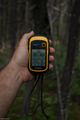
GPS proof
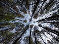
Pine Canopy

