Difference between revisions of "2014-01-12 50 10"
imported>Reinhard (→Expedition) |
imported>FippeBot m (Location) |
||
| Line 27: | Line 27: | ||
[[Category:Expeditions with photos]] | [[Category:Expeditions with photos]] | ||
[[Category:Coordinates reached]] | [[Category:Coordinates reached]] | ||
| + | {{location|DE|TH|HBN}} | ||
Latest revision as of 05:12, 14 August 2019
| Sun 12 Jan 2014 in 50,10: 50.5469398, 10.7559078 geohashing.info google osm bing/os kml crox |
Location
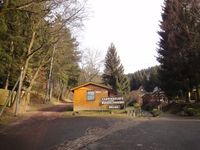
On or next to the campground of Erlau near Suhl (Thuringia, Germany).
Participants
Expedition
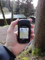
First reasonable hash this year. We were at Manu's parents and I brought my bike, so I could easily reach this Sunday hash before lunch. Just 10 km to Erlau, where I was excited, whether this campground hash would be reachable. The campground (and bungalow village) was opened and while I was at the entrance to think about which path to follow for the last meters to the hashpoint, a woman came over from the restaurant to the reception and asked me, whether she could help me. I told her "not really" and that I was only looking for GPS coordinates on the campground, which is part of an internet game and that I would already leave in 5 minutes or so. To my astonishment she replied something like "Ooh, I see. Okay ..." and let me go as if it would be the most natural thing on earth to look for a set of coordinates on a campground. I then started taking the wrong way since my device was oviously locked to roads and let me think to go in the right direction, but I found out soon, then used the older device (Edge 705 instead of 800) and that got me reliably to the coordinates which were at the slope between trees next to the road that surrounded the campground. So this wasn't a convenient place for the camping achievement which would otherwise have been worth a thought.
For the way back I rode a detour, and thus I ended up with 38 km.
Photos
|


