Difference between revisions of "User:DODO"
imported>DODO (→Reverse regional achievement) |
imported>DODO (→Regional geohashing achievement) |
||
| Line 180: | Line 180: | ||
===Regional geohashing achievement=== | ===Regional geohashing achievement=== | ||
| − | + | This table shows my progress in all possible regional geohashing achievements. If the intersection between an administrative structure and a graticule is smaller than 1 km<sup>2</sup>, I take the liberty to ignore this part. | |
| − | + | {| class="wikitable" | |
| − | + | !Level!!Administrative Structure!!48,8!!49,8!!missing graticules (count) | |
| − | ====Germany==== | + | |-- |
| − | + | |align="center"|1 | |
| − | === | + | |align="center"|Germany |
| − | 2/ | + | |[[2014-03-19 48 8|2014-03-19]] |
| − | ==== | + | |[[2014-02-03 49 8|2014-02-03]] |
| − | + | |s. [[Germany]] (68) | |
| + | |- | ||
| + | |align="center"|2 | ||
| + | |align="center"|Baden-Württemberg | ||
| + | | | ||
| + | |[[2014-02-03 49 8|2014-02-03]] | ||
| + | |s. [[Germany/States#Baden-Württemberg|Baden-Württemberg]] (9) | ||
| + | |- | ||
| + | |align="center"|2 | ||
| + | |align="center"|Rheinland-Pfalz | ||
| + | |[[2014-03-19 48 8|2014-03-19]] | ||
| + | |[[2014-02-08 49 8|2014-02-08]] | ||
| + | |s. [[Germany/States#Rheinland-Pfalz|Rheinland-Pfalz]] (5) | ||
| + | |- | ||
| + | |align="center"|3 | ||
| + | |align="center"|Regierungsbezirk Karlsruhe | ||
| + | | | ||
| + | |[[2014-02-03 49 8|2014-02-03]] | ||
| + | |s. [[Germany/States#Baden-Württemberg|Baden-Württemberg]] (3) | ||
| + | |- | ||
| + | |align="center"|4 | ||
| + | |align="center"|Rhein-Neckar-Kreis | ||
| + | |bgcolor="black"| | ||
| + | |[[2014-02-03 49 8|2014-02-03]] | ||
| + | |49,9 (1) | ||
| + | |- | ||
| + | |align="center"|4 | ||
| + | |align="center"|LK südl. Weinstraße | ||
| + | |bgcolor="black"| | ||
| + | |[[2014-03-16 49 8|2014-03-16]] | ||
| + | |49,7 (1)<sup>1</sup> | ||
| + | |- | ||
| + | |align="center"|4 | ||
| + | |align="center"|Kreis Germersheim | ||
| + | |[[2014-03-19 48 8|2014-03-19]] | ||
| + | | | ||
| + | |49,8 (1) | ||
| + | |- | ||
| + | |- | ||
| + | |} | ||
| + | |||
| + | <sup>1</sup>: The LK südl. Weinstraße has a very small (< 1/2 km<sup>2</sup>) part in the 48,8-graticule | ||
| + | ====Undivided administrative structures==== | ||
| + | * Rhein-Pfalz-Kreis: [[2014-02-08 49 8]] | ||
| + | * Mannheim: [[2014-02-23 49 8]] | ||
| − | |||
| − | |||
===Reverse regional achievement=== | ===Reverse regional achievement=== | ||
All graticules I visited and how many administrative structures I reached | All graticules I visited and how many administrative structures I reached | ||
Revision as of 20:22, 20 March 2014
Contents
Me
Hello out there in the internet, I'm DODO from Speyer. I'm into geohashing since 2014-01-21.
To reach geohashes the following tools declared their consent to carry me:
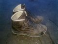
shoes
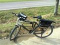
bike

small car (up to 20 KM deviation)
- Picture will follow
big car (up to 10 KM deviation)


Since I don't want to waste more than a liter of fuel for a hash, the deviation-range for the cars is limited (OK, there will be an exception for a global hash just 25 KM away (or an easy accessible hash in the small part of Rheinland-Pfalz in 48_8-graticule), and if I want to drive out for a walk anyway, the actual hashpoint could influence the place, where it takes part, but that doesn't count as deviations, does it?).
Expeditions
| Expedition | MNB1 | Description | |||||||||
|---|---|---|---|---|---|---|---|---|---|---|---|
| 7/9 | 7 | 0 | 2 | 1 | 2 | 6 | 1 | 1 | 1 | 1 | not reached |
| 2014-03-19 48 8 | 7 | 1 | On a footpath near the french border | ||||||||
| 2014-03-16 49 8 | 6 | 2 | Next to Hornbach in Bornheim | ||||||||
| 2014-03-15 49 8 | 5 | 26 | In the forrest near the inlet to the Otterstädter Altrhein | ||||||||
| 2014-02-27 49 8 | 4 | 2 | 6 | On an asparagus field near Grenzhof | |||||||
| 2014-02-23 49 8 | 3 | 66 | 1 | 6 | 5 | On the parking area of a shopping center in Mannheim | |||||
| 2014-02-21 49 8 | 1 | In a blackberry fallow in the center of Sandhausen | |||||||||
| 2014-02-08 49 8 | 2 | On a field near Otterstadt | |||||||||
| 2014-02-07 49 8 | 1 | In a residential house in Mannheim-Neckarau | |||||||||
| 2014-02-03 49 8 | 1 | In the forest west of Bammental |
Legend
1 consecutive number / count
2 distance [KM] / count
3 number of participants (including me) / number of "real meetups"
4 number of first met geohashers / total number of met hashers
5 number of consecutive hashes / number of rows
6 level /max level
Further Achievements
handshakes
DODO earned the Little Finger Handshake achievement
|
- GeorgDerReisende (2014-02-23 49 8)
- Thomcat (2014-02-23 49 8)
- Mampfred, LadyBB and EmmJay (2014-02-23 49 8)
- Danatar (2014-02-27 49 8)
Regional geohashing achievement
This table shows my progress in all possible regional geohashing achievements. If the intersection between an administrative structure and a graticule is smaller than 1 km2, I take the liberty to ignore this part.
| Level | Administrative Structure | 48,8 | 49,8 | missing graticules (count) |
|---|---|---|---|---|
| 1 | Germany | 2014-03-19 | 2014-02-03 | s. Germany (68) |
| 2 | Baden-Württemberg | 2014-02-03 | s. Baden-Württemberg (9) | |
| 2 | Rheinland-Pfalz | 2014-03-19 | 2014-02-08 | s. Rheinland-Pfalz (5) |
| 3 | Regierungsbezirk Karlsruhe | 2014-02-03 | s. Baden-Württemberg (3) | |
| 4 | Rhein-Neckar-Kreis | 2014-02-03 | 49,9 (1) | |
| 4 | LK südl. Weinstraße | 2014-03-16 | 49,7 (1)1 | |
| 4 | Kreis Germersheim | 2014-03-19 | 49,8 (1) |
1: The LK südl. Weinstraße has a very small (< 1/2 km2) part in the 48,8-graticule
Undivided administrative structures
- Rhein-Pfalz-Kreis: 2014-02-08 49 8
- Mannheim: 2014-02-23 49 8
Reverse regional achievement
All graticules I visited and how many administrative structures I reached
Mannheim, Germany
1. Level1: 1/2
2. Level2: 2/4
3. Level3: 2/5
4. Level4: ?/? (To be evaluated)
Pforzheim, Germany
1. Level1: 1/2
2. Level2: 1/3
3. Level3: 1/5
4. Level4: 1/? (To be evaluated)
Legend
1: Countries
2: D: States, F: Regions
3: D: Regierungsbezirke, F: Departements
4: D: Kreise, F: Communes
a: There is indeed a very little (< 0,1 km2) part of Landkreis Südliche Weinstraße in the 48,8-graticule, but I won't list it here is a hashpoint in it