Difference between revisions of "2014-04-14 43 27"
From Geohashing
imported>DODO (→Achievements) |
imported>Palmpje (Adding some implied facts) |
||
| Line 18: | Line 18: | ||
__NOTOC__ | __NOTOC__ | ||
== Location == | == Location == | ||
| − | + | On the side of road 29 between Varna and DObrich | |
== Participants == | == Participants == | ||
| − | + | * [[User:Kisolre | Kisolre]] created the page. | |
| − | |||
== Plans == | == Plans == | ||
<!-- what were the original plans --> | <!-- what were the original plans --> | ||
| + | None are known. | ||
== Expedition == | == Expedition == | ||
<!-- how it all turned out. your narrative goes here. --> | <!-- how it all turned out. your narrative goes here. --> | ||
| + | Proof says they made it. | ||
== Tracklog == | == Tracklog == | ||
| Line 48: | Line 49: | ||
[[Category:Expeditions]] | [[Category:Expeditions]] | ||
| + | [[Category:Expeditions with photos]] | ||
[[Category:Coordinates reached]] | [[Category:Coordinates reached]] | ||
Revision as of 12:21, 17 April 2014
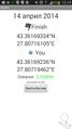
| Mon 14 Apr 2014 in 43,27: 43.3616933, 27.8071611 geohashing.info google osm bing/os kml crox |
Location
On the side of road 29 between Varna and DObrich
Participants
- Kisolre created the page.
Plans
None are known.
Expedition
Proof says they made it.
Tracklog
Photos
Proof @43.3617,27.8073
