Difference between revisions of "2014-08-09 51 9"
imported>GeorgDerReisende m (typo) |
imported>FippeBot m (Location) |
||
| Line 55: | Line 55: | ||
[[Category:Not reached - Mother Nature]] | [[Category:Not reached - Mother Nature]] | ||
| + | {{location|DE|NI|HM}} | ||
Latest revision as of 01:00, 15 August 2019
| Sat 9 Aug 2014 in 51,9: 51.9899008, 9.6287656 geohashing.info google osm bing/os kml crox |
Location
The hash lay at the northeastern side of the mountain range Ith.
Participants
Plans
I wanted to hitchhike to the Ith and to hike to the hash.
Expedition
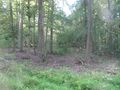
I started at Kassel something late at about 12:00. With two cars and a truck I arrived at the village Kuventhal, from where I had to walk for 45 minutes to Wenzen. Another lift brought me to Eschershausen, but there I had to walk another 30 minutes, at least I arrived at the ridge of the Ith at 16:24. From there I followed a trail along the ridge. The trail became narrower and narrower, sometimes more a mule track. I saw some cliffs at the left side. At a calculated place, where the ridge trail was near to the hash I wanted to walk through the wayless forest, but I found some forest ways, but very wet and muddy. The next way was steep downgoing and wet and on this way the first time as a geohasher I slipped out and found me lying on the back on the way. Coming nearer to the hash, I fell into despair. Of course I am a geohasher, but I am not silly. I found more wet and green overgrown ways and I was too late in the forest. So I gave up. I walked to the outside. But my GPS showed me how near I was to the hash and I started a try from the other side. But I couldn't find the right way and I had no time to find out. So I went out of the forest and found a meadow where I could dry and clean my clothes. Then I hitchhiked home. I started at Fölziehausen at 19:40 and arrived at home at 1:30 a.m.
Photos
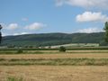
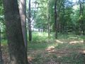
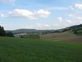
The Ith.
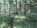
The trail became narrower
and narrower.
A cliff.
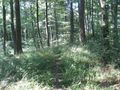
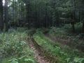
This is a forest way.
This is a muddy forest way.
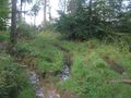
This is a wet forest way.
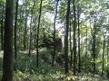
This is the forest way I had to take.
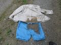
This is the result of a wet and muddy forest way.
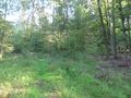
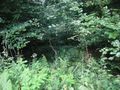
This way?
Or that way?
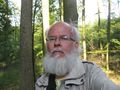
The unlucky geohasher.
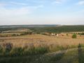
The meadow.
Fölziehausen.


