Difference between revisions of "2015-02-14 51 13"
imported>Danatar (backbone) |
imported>Danatar (Report!) |
||
| Line 17: | Line 17: | ||
== Expedition== | == Expedition== | ||
===[[User:Danatar|Danatar]]=== | ===[[User:Danatar|Danatar]]=== | ||
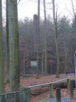
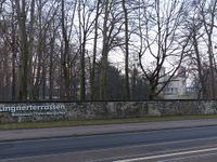
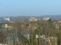
| − | + | How nice, a Saturday hashpoint in Dresden and nice weather. The only problem was that I had to work all day. After work it would be dark, so I decided to visit the hashpoint before work. Sunrise would even be around the time I planned to be at the spot. I got up one hour earlier than usual and at 7 a.m. I started the expedition. I cycled along Fetscherstraße and across the Waldschlösschenbrücke, then along Bauzner Straße until I was at the Lingnerschloss (Lingner Palace, one of the three famous Elbe Palaces). There the track that led to the hashpoint started. I cycled along a small dirt track, not noticing that the easier track towards the hashpoint had already branched off. The track followed the Gutebornbach creek and soon I was near the hashpoint. Sunrise was already 5 minutes past when I found the spot, but in the forest there was little difference. I took pictures, built a marker and then I quickly cycled along the easier forest track to the Lingnerschloss. On my way back I bought bread rolls for breakfast, then I continued to work where I arrived right on time. | |
| − | |||
{{gallery|width=200|height=200|lines=2 | {{gallery|width=200|height=200|lines=2 | ||
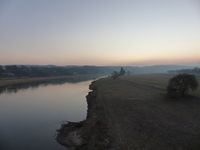
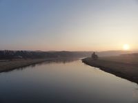
| − | |Image:2015-02- | + | |Image:2015-02-14_51_13_elbe1.jpg|looking towards the hashpoint before sunrise |
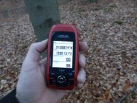
| + | |Image:2015-02-14_51_13_gps.jpg|GPS | ||
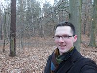
| + | |Image:2015-02-14_51_13_hp.jpg|coordinates reached | ||
| + | |Image:2015-02-14_51_13_pano.jpg|partial panorama | ||
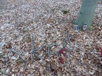
| + | |Image:2015-02-14_51_13_marker.jpg|marker | ||
| + | |Image:2015-02-14_51_13_koenigalbert.jpg|[[Wikipedia:Albert of Saxony|King Albert]] monument | ||
| + | |Image:2015-02-14_51_13_lingnerschloss.jpg|Villa Stockhausen, called Lingner Palace, from behind | ||
| + | |Image:2015-02-14_51_13_elbe2.jpg|looking towards the hashpoint after sunrise | ||
| + | |Image:2015-02-14_51_13_elbschloesser.jpg|the Elbe Palaces during the day, Lingner Palace is the middle one | ||
}} | }} | ||
| Line 33: | Line 40: | ||
[[Category:Expeditions with photos]] | [[Category:Expeditions with photos]] | ||
[[Category:Coordinates reached]] | [[Category:Coordinates reached]] | ||
| − | [[Category:Danatar]] | + | [[Category:Danatar]] |
Revision as of 04:25, 19 February 2015
| Sat 14 Feb 2015 in Dresden: 51.0697436, 13.8113111 geohashing.info google osm bing/os kml crox |
Location
Today's location is in the Dresdner Heide forest at Dresden.
Country: Germany; state: Sachsen (Saxony, EU:DE:SN); district: Dresden; Ortsamt: Loschwitz; Stadtteil: Dresdner Heide
Weather (07:30): fresh, 2°C or less (thermometer still falling when I left), the day got very sunny later
Expedition
Danatar
How nice, a Saturday hashpoint in Dresden and nice weather. The only problem was that I had to work all day. After work it would be dark, so I decided to visit the hashpoint before work. Sunrise would even be around the time I planned to be at the spot. I got up one hour earlier than usual and at 7 a.m. I started the expedition. I cycled along Fetscherstraße and across the Waldschlösschenbrücke, then along Bauzner Straße until I was at the Lingnerschloss (Lingner Palace, one of the three famous Elbe Palaces). There the track that led to the hashpoint started. I cycled along a small dirt track, not noticing that the easier track towards the hashpoint had already branched off. The track followed the Gutebornbach creek and soon I was near the hashpoint. Sunrise was already 5 minutes past when I found the spot, but in the forest there was little difference. I took pictures, built a marker and then I quickly cycled along the easier forest track to the Lingnerschloss. On my way back I bought bread rolls for breakfast, then I continued to work where I arrived right on time.
|
tracklog
will follow
