Difference between revisions of "2015-06-25 50 12"
imported>Danatar (Report!) |
imported>Danatar (→tracklog) |
||
| Line 39: | Line 39: | ||
===tracklog=== | ===tracklog=== | ||
| − | + | [http://www.everytrail.com/view_trip.php?trip_id=3195306&code=e96435b212e633c33dcd8751ac7ded6a Triton tracklog for both hashpoints] | |
[[Category:Expeditions]] | [[Category:Expeditions]] | ||
Revision as of 18:31, 29 July 2015
| Thu 25 Jun 2015 in Chemnitz: 50.1365838, 12.0908543 geohashing.info google osm bing/os kml crox |
Location
Today's location is in a wet meadow directly next to a small pond, near the river Eger/Ohře, near the hamlet Hendelhammer and the city Selb.
Country: Germany; state: Bayern (Bavaria, EU:DE:BY); administrative region: Oberfranken; district: Wunsiedel im Fichtelgebirge
Weather: Sunny, warm
Expedition
Danatar
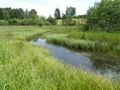
On Friday and Saturday I had a training program in Regensburg. Since I also had compensatory time-off all week, I already went to Regensburg on Thursday instead of hurrying there on Friday morning. First I drove along the Autobahns A4 and A72 until I reached Bavaria. The normal route would be to change onto the A93 near Hof, but the interchange was closed and I had to make a detour that led me through Hof. At Selb I left the Autobahn and drove along the country road that ran alongside the Autobahn until I crossed the Eger, indicating that I was almost there. I parked the car on a track and walked along that track. There were many dragonflies, damselflies, butterflies and, as I realized too late to defend myself, horseflies. Soon I noticed that there was a long pond (or very slow-moving creek) between me and the hashpoint. I tried to circle around it, but it took me a while because it extended quite far and the meadows around it were wet and a bit swampy. Finally I succeeded and approached the hashpoint. It was only two or three steps away from the pond, but the ground was dry enough. I took many pictures of dragonflies and the nice area, then I started back towards the car. After about 10 meters I noticed that my GPS unit was no longer in my pocket. Fearing that I had lost it for good in the high grass I retraced my step and after a bit of searching found it again. Then I went back to the car. Only a few minutes later I was on the Autobahn again, continuing my journey to the 49 12 hashpoint.
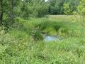
the hashpoint is on the other side of the pond
GPS
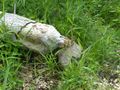
the hashpoint
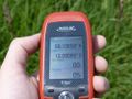
coordinates reached
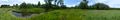
panorama
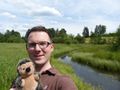
phew, there it is
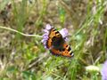
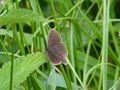
Small tortoiseshell (Aglais urticae)
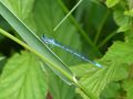
Azure damselfly (Coenagrion puella)
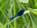
Banded demoiselle (Calopteryx splendens)
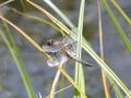
are there beavers here?
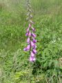
common/purple foxglove (Digitalis purpurea)


