Difference between revisions of "2015-08-03 66 27"
imported>Pastori (Created page with "{{meetup graticule | lat=66 | lon=27 | date=2015-08-03 }} __NOTOC__ == Location == In Lapiosalmi, Posio. The point lies on a dry, sandy area of pine trees. == Participants =...") |
imported>FippeBot m (Location) |
||
| Line 56: | Line 56: | ||
[[Category:Expeditions with photos]] | [[Category:Expeditions with photos]] | ||
[[Category:Coordinates reached]] | [[Category:Coordinates reached]] | ||
| + | {{location|FI|10}} | ||
Revision as of 04:40, 15 August 2019
| Mon 3 Aug 2015 in 66,27: 66.0421194, 27.7341844 geohashing.info google osm bing/os kml crox |
Location
In Lapiosalmi, Posio. The point lies on a dry, sandy area of pine trees.
Participants
- Pastori
- The Wife
Expedition
(Today's third hashpoint attempt. Our first hashpoint 2015-08-03_67_23 and the second 2015-08-03_66_24 )
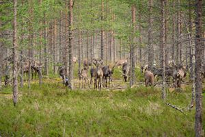
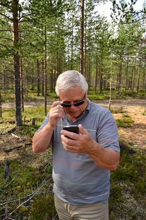
To reach their third hashpoint for the day, Pastori and Wife took a 20 kilometre detour. It was worth it because the point was extremely easy to reach. They had to drive down a back road for 800 metres and the point was on a dry area of pine trees right next to the road. Waiting for Pastori and Wife at the point was a 20-30 headed herd of reindeer. The sun was shining and the triple achievement was ready for the day. Ever the happy hat tricker Pastori made tricks with his hat.
Their hashpoint travels are over for now: 12 days, 3675 km, 10 reached hashpoints and 4 failures. Now they head home to rest wondering when we'll meet again.
Additional photos
Achievements
Pastori and The Wife earned the Multihash Achievement
|
Pastori and The Wife earned the Land geohash achievement
|


