Difference between revisions of "2015-08-06 50 8"
imported>Tads (Created page with "{{subst:Expedition |lat = 50 |lon = 8 |date = 2015-08-06 }}") |
imported>Tads |
||
| Line 1: | Line 1: | ||
| − | |||
| − | |||
| − | |||
| − | |||
| − | |||
| − | |||
| − | |||
| − | |||
| − | |||
| − | |||
{{meetup graticule | {{meetup graticule | ||
| lat=50 | | lat=50 | ||
| Line 19: | Line 9: | ||
== Location == | == Location == | ||
| − | + | In the forest between Dietzenbach and Heusenstamm. | |
== Participants == | == Participants == | ||
| − | + | [[User:Tads|Tads]] ([[User talk:Tads|talk]]) | |
| − | |||
| − | == | + | == Expedition == |
| − | + | For the start of this tour I cycled to Darmstadt train station to catch the S-Bahn to Neu-Isenburg. From there it was just an 8km ride towards the hashpoint. In a distance of 80m from the location I went off my bike and did the hashdance towards the GPS coordinates. I suffered lots of scratches from the thorns on the forest floor but finally reached the coordinates. At the spot I created a wooden X and marked a tree with chalk as can be seen in the pictures. | |
| − | + | The way back to Darmstadt I did on my bike. The weather forecast announced a sunny and hot day, and indeed it was like that. I was happy that about half of this tour went through forests where the shade was much more pleasing than the noon heat on the fields and streets. Still, I had to buy additional drinks along my way. In total I cycled about 47km, which was a great ride for this day. | |
| − | |||
| − | + | Btw, this has been my first expedition in the 50,8 graticule. | |
| − | |||
== Photos == | == Photos == | ||
| − | < | + | <gallery perrow="4"> |
| − | Image: | + | Image:tads_2015-08-06_50_8_marker.jpg | Marker: xkcd and date |
| − | -- | + | Image:tads_2015-08-06_50_8_marker2.jpg | Marker: wooden X |
| − | + | Image:tads_2015-08-06_50_8_proof.png | GPS proof | |
| + | Image:tads_2015-08-06_50_8_surrounding1.jpg | Surrounding: wood | ||
| + | Image:tads_2015-08-06_50_8_surrounding2.jpg | Surrounding: wood | ||
| + | Image:tads_2015-08-06_50_8_surrounding3.jpg | Surrounding: wood | ||
| + | Image:tads_2015-08-06_50_8_surrounding4.jpg | Surrounding: wood | ||
</gallery> | </gallery> | ||
| − | |||
| − | |||
| − | |||
| − | |||
| − | |||
| − | |||
| − | |||
| − | |||
| − | |||
| − | |||
| − | |||
| − | |||
| − | |||
[[Category:Expeditions]] | [[Category:Expeditions]] | ||
| − | |||
[[Category:Expeditions with photos]] | [[Category:Expeditions with photos]] | ||
| − | |||
| − | |||
| − | |||
| − | |||
| − | |||
[[Category:Coordinates reached]] | [[Category:Coordinates reached]] | ||
| − | |||
| − | |||
| − | |||
| − | |||
| − | |||
| − | |||
| − | |||
| − | |||
| − | |||
| − | |||
| − | |||
| − | |||
| − | |||
| − | |||
| − | |||
| − | |||
| − | |||
| − | |||
Revision as of 11:51, 7 August 2015
| Thu 6 Aug 2015 in 50,8: 50.0400912, 8.7803015 geohashing.info google osm bing/os kml crox |
Location
In the forest between Dietzenbach and Heusenstamm.
Participants
Expedition
For the start of this tour I cycled to Darmstadt train station to catch the S-Bahn to Neu-Isenburg. From there it was just an 8km ride towards the hashpoint. In a distance of 80m from the location I went off my bike and did the hashdance towards the GPS coordinates. I suffered lots of scratches from the thorns on the forest floor but finally reached the coordinates. At the spot I created a wooden X and marked a tree with chalk as can be seen in the pictures.
The way back to Darmstadt I did on my bike. The weather forecast announced a sunny and hot day, and indeed it was like that. I was happy that about half of this tour went through forests where the shade was much more pleasing than the noon heat on the fields and streets. Still, I had to buy additional drinks along my way. In total I cycled about 47km, which was a great ride for this day.
Btw, this has been my first expedition in the 50,8 graticule.
Photos

Marker: xkcd and date

Marker: wooden X
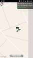
GPS proof
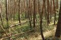
Surrounding: wood
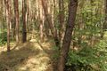
Surrounding: wood
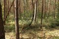
Surrounding: wood
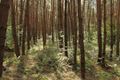
Surrounding: wood


