Difference between revisions of "2015-09-24 63 28"
From Geohashing
imported>Tilley |
imported>Tilley |
||
| Line 32: | Line 32: | ||
| count = 2 | | count = 2 | ||
| latitude = 63 | | latitude = 63 | ||
| − | | longitude = | + | | longitude = 28 |
| date = 2015-09-23 | | date = 2015-09-23 | ||
| name = [[User:Pastori|Pastori]] and The Wife | | name = [[User:Pastori|Pastori]] and The Wife | ||
Revision as of 07:26, 29 September 2015
| Thu 24 Sep 2015 in 63,28: 63.6587427, 28.8378734 geohashing.info google osm bing/os kml crox |
Location
Valtimo, Naurisniemi. The point lies in a field.
Participants
- Pastori
- The Wife
Expedition
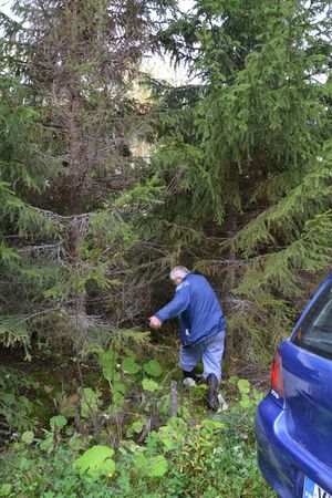
Pastori noticed that there was yet another reachable hashpoint in their own graticule, near the village of Valtimo. So off they went in the afternoon. They drove 17 km on a paved road and 1 km on a field road and walked the remaining 200 m. First they went through a thicket of spruces and then a group of birch trees and then finally the field. There they easily reached the point at an accuracy of 0,43 m. Today's yield was a brisk autumnal weather (with an odour of dung), some deer flies and a cup of coffee with a friend on the way back. That's all for now.
Additional photos
Achievements
Pastori and The Wife earned the Consecutive geohash achievement
|
Pastori and The Wife earned the Land geohash achievement
|


