Difference between revisions of "2015-11-12 47 8"
From Geohashing
imported>Lysogeny |
imported>Chris 47 8 |
||
| Line 52: | Line 52: | ||
<!-- Add any achievement ribbons you earned below, or remove this section --> | <!-- Add any achievement ribbons you earned below, or remove this section --> | ||
| − | |||
| − | |||
| − | |||
| − | |||
[[Category:Not reached - Did not attempt]] | [[Category:Not reached - Did not attempt]] | ||
| − | |||
| − | |||
| − | |||
| − | |||
| − | |||
| − | |||
| − | |||
| − | |||
| − | |||
| − | |||
| − | |||
| − | |||
| − | |||
| − | |||
| − | |||
| − | |||
| − | |||
| − | |||
| − | |||
| − | |||
| − | |||
| − | |||
| − | |||
| − | |||
| − | |||
| − | |||
| − | |||
| − | |||
| − | |||
Revision as of 11:22, 21 November 2015
| Thu 12 Nov 2015 in 47,8: 47.6691404, 8.8565536 geohashing.info google osm bing/os kml crox |
Location
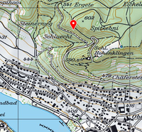
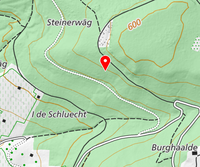
Hillside forest by Stein am Rhein, Switzerland
Participants
Plans
The hash seems to be on a hill-side. The incline should not be too steep, so it should be possible to reach the hash. The hash is also located between two roads, allowing an alternate vector if one of the roads should have the hash inaccessible.
Expedition
Due to time constraints I unfortunately can not do this.

