Difference between revisions of "2015-11-20 47 19"
imported>Codae (Created page with "{{subst:Expedition |lat = 47 |lon = 19 |date = 2015-11-20 }}") |
imported>Codae |
||
| Line 20: | Line 20: | ||
== Location == | == Location == | ||
<!-- where you've surveyed the hash to be --> | <!-- where you've surveyed the hash to be --> | ||
| + | In a park in Újhegy, Budapest. | ||
== Participants == | == Participants == | ||
<!-- who attended: If you link to your wiki user name in this section, your expedition will be picked up by the various statistics generated for geohashing. You may use three tildes ~ as a shortcut to automatically insert the user signature of the account you are editing with. | <!-- who attended: If you link to your wiki user name in this section, your expedition will be picked up by the various statistics generated for geohashing. You may use three tildes ~ as a shortcut to automatically insert the user signature of the account you are editing with. | ||
--> | --> | ||
| + | [[User:Codae|Codae]] | ||
== Plans == | == Plans == | ||
<!-- what were the original plans --> | <!-- what were the original plans --> | ||
| + | This looked like a good opportunity for a [[Tron Geohash]], being accessible from my apartment along a few completely separate public-transit routes. So I decided to head out there on the metro and come back on the tram. | ||
== Expedition == | == Expedition == | ||
<!-- how it all turned out. your narrative goes here. --> | <!-- how it all turned out. your narrative goes here. --> | ||
| + | The outbound ride worked out fine: as I'd hoped, transferring from trolleybus to metro to tram to other metro, then leaving the Kőbánya-Kispest terminal metro station, was achievable without crossing my path (though there was a scare when I mistook a dead end for an exit, which I resolved by hugging the wall on the way back). Of course, this route was mostly underground, so I didn't get a good GPS tracklog. | ||
| + | |||
| + | Unfortunately, I messed up on the walk from there to the geohash by failing to recognize the south side of the relevant green space until after I had already passed it. So, intent on preserving the Tron, I looped around to the north side, intending to step into the park, collect, and step out before heading further north to the route home. This plan foundered on the discovery that the north side of the park was fenced off. | ||
| + | |||
| + | I did find an open gate and so entered, reaching the hashpoint (success!). But there weren't any others on the north side. In total, I counted three passages between the lot and the rest of the world: the gate I had used to get in, a gate I had walked right past on my way to the hash, and a hole in the chain-link fence communicating with the end of a driveway for the next lot over. I couldn't see where I could go from that pocket: the east side was my entry, the north side a closed auto gate, the west side a barbed-wire fence, and the south side, the connection to the street, blocked by my outbound path. But it was my only way forward, so I went in there to ponder my next steps. | ||
| + | |||
| + | A man appeared within the fenced-off lot, I assume a weekend security guard. I realized that my Tron attempt, if it was still possible, was entirely within his hands, as it was only with his aid that I could pass through the gate and then, perhaps, to freedom. I waved him over and asked if I could go in. | ||
| + | |||
| + | He said no. | ||
| + | |||
| + | So I abandoned the Tron and returned home the way I had come, disappointed at how much my GPS battery had been worn down by the continuous use. | ||
== Tracklog == | == Tracklog == | ||
| Line 39: | Line 53: | ||
--> | --> | ||
<gallery perrow="5"> | <gallery perrow="5"> | ||
| + | Image:2015-11-20 47 19 Proof.JPG | Success! | ||
| + | Image:2015-11-20 47 19 Chair.JPG | A chair sitting around near the hashpoint. | ||
</gallery> | </gallery> | ||
| Line 44: | Line 60: | ||
{{#vardefine:ribbonwidth|800px}} | {{#vardefine:ribbonwidth|800px}} | ||
<!-- Add any achievement ribbons you earned below, or remove this section --> | <!-- Add any achievement ribbons you earned below, or remove this section --> | ||
| + | {{Land geohash|latitude=47|longitude=19|date=2015-11-20|name=Codae}} | ||
| + | {{Public transport geohash|latitude=47|longitude=19|date=2015-11-20|name=Codae}} | ||
| + | |||
<!-- =============== USEFUL CATEGORIES FOLLOW ================ | <!-- =============== USEFUL CATEGORIES FOLLOW ================ | ||
Delete the next line ONLY if you have chosen the appropriate categories below. If you are unsure, don't worry. People will read your report and help you with the classification. --> | Delete the next line ONLY if you have chosen the appropriate categories below. If you are unsure, don't worry. People will read your report and help you with the classification. --> | ||
| − | + | ||
<!-- Potential categories. Please include all the ones appropriate to your expedition --> | <!-- Potential categories. Please include all the ones appropriate to your expedition --> | ||
| − | |||
| − | |||
| − | |||
| − | + | [[Category:Expeditions]] | |
| − | |||
| − | |||
| − | |||
[[Category:Expeditions with photos]] | [[Category:Expeditions with photos]] | ||
| − | |||
| − | |||
| − | |||
| − | |||
[[Category:Coordinates reached]] | [[Category:Coordinates reached]] | ||
| − | |||
| − | |||
| − | |||
| − | |||
| − | |||
| − | |||
| − | |||
| − | |||
| − | |||
| − | |||
| − | |||
| − | |||
| − | |||
| − | |||
| − | |||
| − | |||
| − | |||
| − | |||
Revision as of 13:05, 13 December 2015
| Fri 20 Nov 2015 in 47,19: 47.4654297, 19.1601738 geohashing.info google osm bing/os kml crox |
Location
In a park in Újhegy, Budapest.
Participants
Plans
This looked like a good opportunity for a Tron Geohash, being accessible from my apartment along a few completely separate public-transit routes. So I decided to head out there on the metro and come back on the tram.
Expedition
The outbound ride worked out fine: as I'd hoped, transferring from trolleybus to metro to tram to other metro, then leaving the Kőbánya-Kispest terminal metro station, was achievable without crossing my path (though there was a scare when I mistook a dead end for an exit, which I resolved by hugging the wall on the way back). Of course, this route was mostly underground, so I didn't get a good GPS tracklog.
Unfortunately, I messed up on the walk from there to the geohash by failing to recognize the south side of the relevant green space until after I had already passed it. So, intent on preserving the Tron, I looped around to the north side, intending to step into the park, collect, and step out before heading further north to the route home. This plan foundered on the discovery that the north side of the park was fenced off.
I did find an open gate and so entered, reaching the hashpoint (success!). But there weren't any others on the north side. In total, I counted three passages between the lot and the rest of the world: the gate I had used to get in, a gate I had walked right past on my way to the hash, and a hole in the chain-link fence communicating with the end of a driveway for the next lot over. I couldn't see where I could go from that pocket: the east side was my entry, the north side a closed auto gate, the west side a barbed-wire fence, and the south side, the connection to the street, blocked by my outbound path. But it was my only way forward, so I went in there to ponder my next steps.
A man appeared within the fenced-off lot, I assume a weekend security guard. I realized that my Tron attempt, if it was still possible, was entirely within his hands, as it was only with his aid that I could pass through the gate and then, perhaps, to freedom. I waved him over and asked if I could go in.
He said no.
So I abandoned the Tron and returned home the way I had come, disappointed at how much my GPS battery had been worn down by the continuous use.
Tracklog
Photos
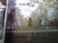
Success!
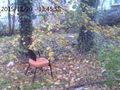
A chair sitting around near the hashpoint.


Achievements
Codae earned the Land geohash achievement
|
Codae earned the Public transport geohash achievement
|