Difference between revisions of "2016-03-08 49 12"
imported>Danatar ([live picture]Reached! [http://www.openstreetmap.org/?lat=49.96473960&lon=12.03610970&zoom=16&layers=B000FTF @49.9647,12.0361]) |
imported>Danatar (Report!) |
||
| Line 1: | Line 1: | ||
| − | + | {{meetup graticule | |
| − | |||
| − | |||
| − | |||
| − | |||
| − | |||
| − | |||
| − | |||
| − | |||
| − | |||
| − | {{meetup graticule | ||
| lat=49 | | lat=49 | ||
| lon=12 | | lon=12 | ||
| date=2016-03-08 | | date=2016-03-08 | ||
| − | }} | + | | graticule_name=Regensburg |
| − | + | | graticule_link=Regensburg, Germany | |
| − | + | }}__NOTOC__ | |
| − | + | == Location == | |
| − | + | Today's location is... | |
| − | |||
| − | + | Country: Germany; state: Bayern (Bavaria, EU:DE:BY); Regierungsbezirk: Oberpfalz; district: Tirschenreuth | |
| − | |||
| − | |||
| − | + | Weather: cloudy, varying between sunny and light snowing, 3°C | |
| − | |||
| − | |||
| − | |||
| − | == | + | == Expedition== |
| − | + | ===[[User:Danatar|Danatar]]=== | |
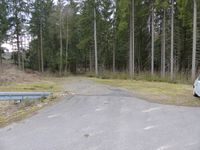
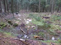
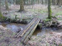
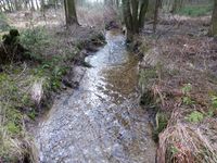
| − | + | After meeting a friend in Pegnitz (and returning the skiing equipment that had been in my car since [[2016-02-19_49_11|2016-02-19]]), I took a route along country roads towards the hashpoint. The weather was sometimes sunny, sometimes clouded with light snowing that instantly melted on the ground. I passed towns that I had never heard the name of until after 50 minutes I stopped the car next to the forest near the hashpoint. First I walked along a small track and when that one disappeared I just walked through the sparce underbrush. Now and again I was able to follow a tiny trail for a while. One of these trails led me to a tiny bridge across the ''Kreuzweiher Bächl'' creek. It consisted of nothing more than a few logs, but it was very helpful. Across other, even tinier runlets I had to balance carefully. My way led me across a thick cover of moss and past small pathes of snow, until I reached the hashpoint after crossing an area of tiny conifers. It was in a small patch of snow, with a snow-free animal trail leading right across it. | |
| − | |||
| − | |||
| − | |||
<gallery perrow="5"> | <gallery perrow="5"> | ||
Image:2016-03-08_49_12_Danatar_1457447691377.jpg|Reached! [http://www.openstreetmap.org/?lat=49.96473960&lon=12.03610970&zoom=16&layers=B000FTF @49.9647,12.0361] | Image:2016-03-08_49_12_Danatar_1457447691377.jpg|Reached! [http://www.openstreetmap.org/?lat=49.96473960&lon=12.03610970&zoom=16&layers=B000FTF @49.9647,12.0361] | ||
</gallery> | </gallery> | ||
| + | I took pictures and built a small marker out of twigs. While I was doing that, a loud ruckus started, somewhere above me a large number of birds shouted. It sounded as if they were flying around above the treetops but I didn't see anything. Soon after, I walked back to the car. After driving through Marktredwitz, I came to the Autobahn A93 and continued towards the [[2016-03-08 50 13|50 13]] hashpoint. | ||
| + | |||
| − | == | + | {{gallery|width=200|height=200|lines=2 |
| − | + | |Image:2016-03-08_49_12_start.jpg|starting to walk at the car | |
| − | + | |Image:2016-03-08_49_12_weg.jpg|first obstacle on the trail | |
| + | |Image:2016-03-08_49_12_bruecke.jpg|a bridge just for me... | ||
| + | |Image:2016-03-08_49_12_bach.jpg|...across the ''Kreuzweiher Bächl'' | ||
| + | |Image:2016-03-08_49_12_moos2.jpg|across the moss | ||
| + | |Image:2016-03-08_49_12_spot.jpg|the hashpoint | ||
| + | |Image:2016-03-08_49_12_gps.jpg|GPS | ||
| + | |Image:2016-03-08_49_12_hp.jpg|coordinates reached | ||
| + | |Image:2016-03-08_49_12_pano.jpg|panorama | ||
| + | |Image:2016-03-08_49_12_marker.jpg|the internet was here | ||
| + | |Image:2016-03-08_49_12_moos1.jpg| | ||
| + | }} | ||
| − | |||
| − | |||
| − | |||
| − | |||
| − | |||
| − | |||
| − | |||
| − | + | ===tracklog=== | |
| + | [http://www.everytrail.com/view_trip.php?trip_id=3409903&code=4815b5ff4cb5c7e8a6f4e4dd0008923a Triton tracklog] | ||
| − | |||
[[Category:Expeditions]] | [[Category:Expeditions]] | ||
| − | |||
[[Category:Expeditions with photos]] | [[Category:Expeditions with photos]] | ||
| − | |||
| − | |||
| − | |||
| − | |||
| − | |||
[[Category:Coordinates reached]] | [[Category:Coordinates reached]] | ||
| − | + | [[Category:Danatar]] | |
| − | |||
| − | |||
| − | |||
| − | |||
| − | |||
| − | |||
| − | |||
| − | |||
| − | |||
| − | |||
| − | |||
| − | |||
| − | |||
| − | |||
| − | [[Category: | ||
| − | |||
| − | |||
Revision as of 19:23, 10 March 2016
| Tue 8 Mar 2016 in Regensburg: 49.9647426, 12.0361254 geohashing.info google osm bing/os kml crox |
Location
Today's location is...
Country: Germany; state: Bayern (Bavaria, EU:DE:BY); Regierungsbezirk: Oberpfalz; district: Tirschenreuth
Weather: cloudy, varying between sunny and light snowing, 3°C
Expedition
Danatar
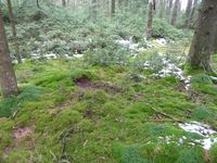
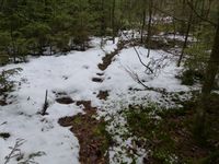
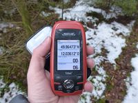
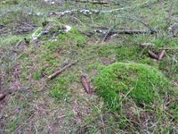
After meeting a friend in Pegnitz (and returning the skiing equipment that had been in my car since 2016-02-19), I took a route along country roads towards the hashpoint. The weather was sometimes sunny, sometimes clouded with light snowing that instantly melted on the ground. I passed towns that I had never heard the name of until after 50 minutes I stopped the car next to the forest near the hashpoint. First I walked along a small track and when that one disappeared I just walked through the sparce underbrush. Now and again I was able to follow a tiny trail for a while. One of these trails led me to a tiny bridge across the Kreuzweiher Bächl creek. It consisted of nothing more than a few logs, but it was very helpful. Across other, even tinier runlets I had to balance carefully. My way led me across a thick cover of moss and past small pathes of snow, until I reached the hashpoint after crossing an area of tiny conifers. It was in a small patch of snow, with a snow-free animal trail leading right across it.
Reached! @49.9647,12.0361
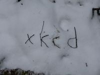
I took pictures and built a small marker out of twigs. While I was doing that, a loud ruckus started, somewhere above me a large number of birds shouted. It sounded as if they were flying around above the treetops but I didn't see anything. Soon after, I walked back to the car. After driving through Marktredwitz, I came to the Autobahn A93 and continued towards the 50 13 hashpoint.
|

