Difference between revisions of "2016-04-16 47 -122"
From Geohashing
imported>Thomcat (Better late than never) |
imported>Thomcat ([live picture]Hwy 520 [http://www.openstreetmap.org/?lat=47.64206350&lon=-122.30924800&zoom=16&layers=B000FTF @47.6421,-122.3092]) |
||
| Line 29: | Line 29: | ||
--> | --> | ||
<gallery perrow="5"> | <gallery perrow="5"> | ||
| + | |||
| + | Image:2016-04-16_47_-122_thomcat_1460859093583.jpg|Hwy 520 [http://www.openstreetmap.org/?lat=47.64206350&lon=-122.30924800&zoom=16&layers=B000FTF @47.6421,-122.3092] | ||
</gallery> | </gallery> | ||
Revision as of 02:11, 17 April 2016
| Sat 16 Apr 2016 in Seattle: 47.6422736, -122.3089662 geohashing.info google osm bing/os kml crox |
Location
On the Montlake playfield, just south of the 520 bridge.
Participants
Plans
This is a very easy hashpoint to arrive at, within a few blocks of the new Light Rail station in Seattle's University District. I plan to arrive at this very centrally located area at 4. Open to a stroll along the arboretum waterfront trail before or afterward.
- Nobody took me up on the offer, went to see Jungle Book instead - it was pretty good. Headed over there now. --Thomcat (talk) 01:33, 17 April 2016 (UTC)
Expedition
Tracklog
Photos
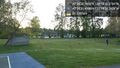
Hwy 520 @47.6421,-122.3092

Achievements