Difference between revisions of "2016-08-20 52 1"
From Geohashing
imported>Sourcerer m (→Expedition Stats) |
imported>Sourcerer m ([live picture] Arrived. [http://www.openstreetmap.org/?lat=52.20136106&lon=1.29706264&zoom=16&layers=B000FTF @52.2014,1.2971]) |
||
| Line 29: | Line 29: | ||
== Photos == | == Photos == | ||
<gallery caption="Photo Gallery" perrow="3"> | <gallery caption="Photo Gallery" perrow="3"> | ||
| + | |||
| + | Image:2016-08-20_52_1_Sourcerer_1471647691169.jpg | Arrived. [http://www.openstreetmap.org/?lat=52.20136106&lon=1.29706264&zoom=16&layers=B000FTF @52.2014,1.2971] | ||
</gallery> | </gallery> | ||
Revision as of 23:03, 19 August 2016
| Sat 20 Aug 2016 in Norwich, UK: 52.2013648, 1.2970473 geohashing.info google osm bing/os kml crox |
Location
A field NE of Brandeston, Suffolk, UK.
Participants
Plans
Two of two spanning midnight - 2016-08-19 52 1 - 2016-08-20 52 1 - ETA 00:00.
Expedition
If all goes to plan, Norwich, United Kingdom will draw equal to Mannheim, Germany, counting coordinates reached.
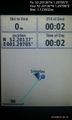
This image shows the position a few hours before the expeditions. It's included here before the dates are lost in the mists of wiki history.

Photos
- Photo Gallery
Arrived. @52.2014,1.2971

Achievements
Expeditions and Plans
| 2016-08-20 | ||
|---|---|---|
| Wien, Austria | Micsnare | Vienna, 14th district (Penzing) - in a backyard of a housing estate |
| Kassel, Germany | GeorgDerReisende | The hash lay on the side of a field north of Niedenstein-Kirchberg. |
| Norwich, United Kingdom | Sourcerer | A field NE of Brandeston, Suffolk, UK. |
| Utrecht, Netherlands | FelixTheCat | A residential area in Baarn. |
Sourcerer's Expedition Links
2016-08-19 52 1 - 2016-08-20 52 1 - 2016-08-21 52 1 - KML file download of Sourcerer's expeditions for use with Google Earth.