Difference between revisions of "2016-10-24 47 -122"
From Geohashing
imported>Thomcat ([live picture]Self [http://www.openstreetmap.org/?lat=47.66968700&lon=-122.12323420&zoom=16&layers=B000FTF @47.6697,-122.1232]) |
imported>Thomcat ([live picture]Bookstore [http://www.openstreetmap.org/?lat=47.67302430&lon=-122.12350320&zoom=16&layers=B000FTF @47.6730,-122.1235]) |
||
| Line 32: | Line 32: | ||
Image:2016-10-24_47_-122_thomcat_1477347661551.jpg|Self [http://www.openstreetmap.org/?lat=47.66968700&lon=-122.12323420&zoom=16&layers=B000FTF @47.6697,-122.1232] | Image:2016-10-24_47_-122_thomcat_1477347661551.jpg|Self [http://www.openstreetmap.org/?lat=47.66968700&lon=-122.12323420&zoom=16&layers=B000FTF @47.6697,-122.1232] | ||
| + | |||
| + | Image:2016-10-24_47_-122_thomcat_1477347913920.jpg|Bookstore [http://www.openstreetmap.org/?lat=47.67302430&lon=-122.12350320&zoom=16&layers=B000FTF @47.6730,-122.1235] | ||
</gallery> | </gallery> | ||
Revision as of 22:25, 24 October 2016
| Mon 24 Oct 2016 in Seattle: 47.6696778, -122.1232102 geohashing.info google osm bing/os kml crox |
Location
On a side street in Redmond Town Center, easily reachable.
Participants
Plans
Stop by after work, then take the toll bridge back to Seattle.
Expedition
Tracklog
Photos
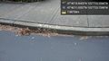
Curb @47.6697,-122.1233

Self @47.6697,-122.1232
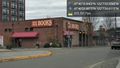
Bookstore @47.6730,-122.1235


Achievements