Difference between revisions of "2017-07-02 50 7"
imported>DODO |
imported>DODO (→Achievements) |
||
| Line 60: | Line 60: | ||
| latitude = 49 | | latitude = 49 | ||
| longitude = 8 | | longitude = 8 | ||
| − | | date = 2017- | + | | date = 2017-07-02 |
| name = DODO | | name = DODO | ||
}} | }} | ||
Revision as of 18:00, 11 October 2017
| Sun 2 Jul 2017 in 50,7: 50.2779550, 7.5688851 geohashing.info google osm bing/os kml crox |
Location
In a forest next to a ditch near Waldesch.
Participants
Plans
I had to drive to Neuwied at this weekend and as always I had a look for a nice hashing-occasion. And I found this one just next to my way back.
Expedition
I hoped that I could drive into a road for 1 KM but the road was blocked for by road works. So I had to park the car at the entrance to the road. I followed the road for the said kilometer and entered the forest there. The hash was less than 400m from here, but komoot didn't know many pathes towards it and so I had to improvise. I just followed some tracktor tracks and walked without a way always downwards in the direcrtion of the hash. I crossed another way and reached the ditch that should be close to the hash. Here I left his opath again and followed the upper bench of the ditch. When it was only 20 mor meters to the hash I found another wide path that lead me almost direct to the searched point. After a little dance I reached what I (and hashdroid also) called close enough. It was just in front of the steep bank of the ditch. I took some pictures, constructed a quick and easy mark and followed the found way.
From here it started raining, and when I reached the car almost half an hour later I would have earned a drowned rat - if rain had only started earlier :-)
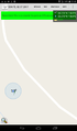
Tracklog
Photos
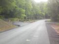
where I left the road
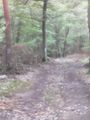
the first path I found
proof
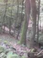
the ditch (south)
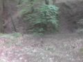
up the ditch (west)
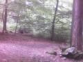
the path (north)

the hasher (any direction)
mark


Achievements
DODO earned the Land geohash achievement
|