Difference between revisions of "2018-03-15 47 -122"
From Geohashing
imported>Thomcat ([live picture]Trail edge [http://www.openstreetmap.org/?lat=47.81032490&lon=-122.36121020&zoom=16&layers=B000FTF @47.8103,-122.3612]) |
imported>Thomcat ([live picture]From below [http://www.openstreetmap.org/?lat=47.81023930&lon=-122.36121610&zoom=16&layers=B000FTF @47.8102,-122.3612]) |
||
| Line 30: | Line 30: | ||
Image:2018-03-15_47_-122_thomcat_1521156903323.jpg|Trail edge [http://www.openstreetmap.org/?lat=47.81032490&lon=-122.36121020&zoom=16&layers=B000FTF @47.8103,-122.3612] | Image:2018-03-15_47_-122_thomcat_1521156903323.jpg|Trail edge [http://www.openstreetmap.org/?lat=47.81032490&lon=-122.36121020&zoom=16&layers=B000FTF @47.8103,-122.3612] | ||
| + | |||
| + | Image:2018-03-15_47_-122_thomcat_1521157057677.jpg|From below [http://www.openstreetmap.org/?lat=47.81023930&lon=-122.36121610&zoom=16&layers=B000FTF @47.8102,-122.3612] | ||
</gallery> | </gallery> | ||
Revision as of 23:37, 15 March 2018
| Thu 15 Mar 2018 in Seattle: 47.8101643, -122.3612661 geohashing.info google osm bing/os kml crox |
Location
A return to Yost park, on a much easier to reach trail. Quite near a bus stop!
Participants
Plans
Stop by after work.
Expedition
I went to Yost park as part of a previous expedition, and returned the following weekend with my family. Will try to find those photos, in case of deja vu. If things are unchanged, this spot will be much easier to reach than the last time. Bus 116 is also nearby, Main St & Olympic Ave.
Tracklog
Photos
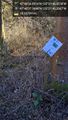
Trail edge @47.8103,-122.3612
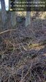
From below @47.8102,-122.3612


Achievements