Difference between revisions of "2018-07-25 47 -122"
From Geohashing
imported>Thomcat ([live picture]Geohasher [http://www.openstreetmap.org/?lat=47.73988120&lon=-122.25440840&zoom=16&layers=B000FTF @47.7399,-122.2544]) |
imported>Thomcat ([live picture]Arrowhead Elem [http://www.openstreetmap.org/?lat=47.73807790&lon=-122.25131760&zoom=16&layers=B000FTF @47.7381,-122.2513]) |
||
| Line 34: | Line 34: | ||
Image:2018-07-25_47_-122_thomcat_1532544975986.jpg|Geohasher [http://www.openstreetmap.org/?lat=47.73988120&lon=-122.25440840&zoom=16&layers=B000FTF @47.7399,-122.2544] | Image:2018-07-25_47_-122_thomcat_1532544975986.jpg|Geohasher [http://www.openstreetmap.org/?lat=47.73988120&lon=-122.25440840&zoom=16&layers=B000FTF @47.7399,-122.2544] | ||
| + | |||
| + | Image:2018-07-25_47_-122_thomcat_1532545114314.jpg|Arrowhead Elem [http://www.openstreetmap.org/?lat=47.73807790&lon=-122.25131760&zoom=16&layers=B000FTF @47.7381,-122.2513] | ||
</gallery> | </gallery> | ||
Revision as of 18:58, 25 July 2018
| Wed 25 Jul 2018 in Seattle: 47.7398652, -122.2544036 geohashing.info google osm bing/os kml crox |
Location
Just of 154th street, south of Inglemoor golf course.
Participants
Plans
Stop by early afternoon with sidewalk chalk.
Expedition
Tracklog
Photos
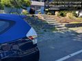
Near @47.7399,-122.2544
Mark @47.7399,-122.2545

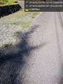
Geohasher @47.7399,-122.2544
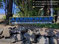
Arrowhead Elem @47.7381,-122.2513


Achievements