Difference between revisions of "2019-01-16 49 8"
From Geohashing
imported>GeorgDerReisende (new report) |
imported>GeorgDerReisende (expedition report for Mörfelden-Walldorf) |
||
| Line 1: | Line 1: | ||
| − | |||
| − | |||
| − | |||
| − | |||
| − | |||
| − | |||
| − | |||
| − | |||
| − | |||
| − | |||
{{meetup graticule | {{meetup graticule | ||
| lat=49 | | lat=49 | ||
| Line 19: | Line 9: | ||
== Location == | == Location == | ||
| − | + | ||
| + | The hash lay behind a fence in Mörfelden. | ||
== Participants == | == Participants == | ||
| − | + | ||
| − | + | [[User:GeorgDerReisende|GeorgDerReisende]] | |
== Plans == | == Plans == | ||
| − | + | ||
| + | Traveling by public transport to Mörfelden and walking. | ||
== Expedition == | == Expedition == | ||
| − | |||
| − | + | I left home at 10 a.m. and arrived by train at Mörfelden after 1 p.m.. I walked to the hash and found it four meters behind a fence. Nothing more to write. | |
| − | |||
== Photos == | == Photos == | ||
| − | |||
| − | |||
| − | |||
<gallery perrow="5"> | <gallery perrow="5"> | ||
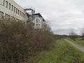
| + | 2019-01-16 49 8 GeorgDerReisende 4871.jpg | arrived at Mörfelden | ||
| + | 2019-01-16 49 8 GeorgDerReisende 4921.jpg | where is the hash? on which side of the fence? | ||
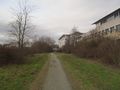
| + | 2019-01-16 49 8 GeorgDerReisende 4923.jpg | about there | ||
| + | 2019-01-16 49 8 GeorgDerReisende 4924.jpg | from the footway 12 meters to go | ||
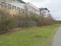
| + | 2019-01-16 49 8 GeorgDerReisende 4925.jpg | four meters behind the fence | ||
| + | 2019-01-16 49 8 GeorgDerReisende 4926.jpg | looking north | ||
| + | 2019-01-16 49 8 GeorgDerReisende 4927.jpg | the west | ||
| + | 2019-01-16 49 8 GeorgDerReisende 4928.jpg | the south | ||
| + | 2019-01-16 49 8 GeorgDerReisende 4929.jpg | the east | ||
| + | 2019-01-16 49 8 GeorgDerReisende 4930.jpg | the geohasher | ||
| + | 2019-01-16 49 8 GeorgDerReisende 4931.jpg | looking back to the hash | ||
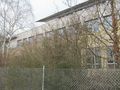
| + | 2019-01-16 49 8 GeorgDerReisende 4934.jpg | at the north side of the hash were houses, on the south side of the hash there was a lake | ||
</gallery> | </gallery> | ||
| − | + | [[Category:Expeditions]] | |
| − | |||
| − | |||
| − | + | [[Category:Expeditions with photos]] | |
| − | |||
| − | [[Category: | ||
| − | |||
| − | |||
| − | |||
| − | |||
| − | |||
| − | |||
| − | |||
| − | |||
| − | |||
| − | |||
| − | |||
| − | |||
| − | |||
| − | |||
| − | |||
| − | |||
| − | |||
| − | |||
| − | |||
| − | |||
[[Category:Coordinates reached]] | [[Category:Coordinates reached]] | ||
| − | |||
| − | |||
| − | |||
| − | |||
| − | |||
| − | |||
| − | |||
| − | |||
| − | |||
| − | |||
| − | |||
| − | |||
| − | |||
| − | |||
| − | |||
| − | |||
| − | |||
| − | |||
Revision as of 10:55, 20 January 2019
| Wed 16 Jan 2019 in 49,8: 49.9857271, 8.5867775 geohashing.info google osm bing/os kml crox |
Location
The hash lay behind a fence in Mörfelden.
Participants
Plans
Traveling by public transport to Mörfelden and walking.
Expedition
I left home at 10 a.m. and arrived by train at Mörfelden after 1 p.m.. I walked to the hash and found it four meters behind a fence. Nothing more to write.
Photos
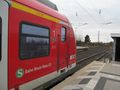
arrived at Mörfelden
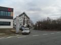
where is the hash? on which side of the fence?
about there
from the footway 12 meters to go
four meters behind the fence
looking north
the west
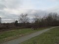
the south
the east
- Error creating thumbnail: Unable to save thumbnail to destination
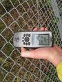
the geohasher
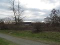
looking back to the hash
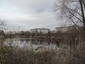
at the north side of the hash were houses, on the south side of the hash there was a lake


