Difference between revisions of "2019-08-07 43 -79"
From Geohashing
imported>Frogman m |
imported>Frogman |
||
| Line 1: | Line 1: | ||
| + | [[Image:{{{image|2019-08-07_43_-79_frogman_1565222240191.jpg}}}|thumb|left]] | ||
| − | |||
| − | |||
| − | |||
| − | |||
| − | |||
| − | |||
| − | |||
| − | |||
| − | |||
{{meetup graticule | {{meetup graticule | ||
| lat=43 | | lat=43 | ||
| Line 15: | Line 7: | ||
}} | }} | ||
| − | + | ||
__NOTOC__ | __NOTOC__ | ||
== Location == | == Location == | ||
| − | + | In a grassy field in E. T. Seton Park. | |
== Participants == | == Participants == | ||
| − | + | *[[User:Frogman|Frogman]] | |
| − | |||
| − | |||
| − | |||
| − | |||
== Expedition == | == Expedition == | ||
| − | + | After a meeting, I headed out from the office to this easy hashpoint. I took Line 2 out to Broadview Station, and then the 100A Flemingdon Park bus to Overlea Boulevard at Don Mills Road. From there I headed down the Lower Don Recreation Trail to the park, snapped a couple of pictures, and left. I decided that, instead of returning the way I came, I would head down to O'Connor Drive. Readers may recall that my [[2017-11-10 43 -79|67th expedition]] was on O'Connor Drive as well. In fact, I could see the location of that hashpoint in the distance! The 70A O'Connor bus showed up pretty quickly, so I didn't get the chance to swing by for a cheeky retro-hash. | |
| − | |||
| − | |||
| − | |||
== Photos == | == Photos == | ||
| Line 80: | Line 65: | ||
{{#vardefine:ribbonwidth|800px}} | {{#vardefine:ribbonwidth|800px}} | ||
<!-- Add any achievement ribbons you earned below, or remove this section --> | <!-- Add any achievement ribbons you earned below, or remove this section --> | ||
| + | {{Public transport geohash | ||
| − | + | | latitude = 43 | |
| − | + | | longitude = -79 | |
| − | + | | date = 2019-08-07 | |
| − | + | | busline = the TTC | |
| − | + | | name = [[User:Frogman|Frogman]] | |
| − | |||
| − | |||
| − | |||
| − | [[ | ||
| − | |||
| − | + | }} | |
| − | |||
[[Category:Expeditions]] | [[Category:Expeditions]] | ||
| − | |||
[[Category:Expeditions with photos]] | [[Category:Expeditions with photos]] | ||
| − | |||
| − | |||
| − | |||
| − | |||
| − | |||
[[Category:Coordinates reached]] | [[Category:Coordinates reached]] | ||
| − | |||
| − | |||
| − | |||
| − | |||
| − | |||
| − | |||
| − | |||
| − | |||
| − | |||
| − | |||
| − | |||
| − | |||
| − | |||
| − | |||
| − | |||
| − | |||
| − | |||
| − | |||
Revision as of 00:21, 8 August 2019
| Wed 7 Aug 2019 in 43,-79: 43.7057518, -79.3375674 geohashing.info google osm bing/os kml crox |
Location
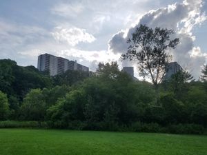
In a grassy field in E. T. Seton Park.
Participants
Expedition
After a meeting, I headed out from the office to this easy hashpoint. I took Line 2 out to Broadview Station, and then the 100A Flemingdon Park bus to Overlea Boulevard at Don Mills Road. From there I headed down the Lower Don Recreation Trail to the park, snapped a couple of pictures, and left. I decided that, instead of returning the way I came, I would head down to O'Connor Drive. Readers may recall that my 67th expedition was on O'Connor Drive as well. In fact, I could see the location of that hashpoint in the distance! The 70A O'Connor bus showed up pretty quickly, so I didn't get the chance to swing by for a cheeky retro-hash.
Photos
Achievements
Frogman earned the Public transport geohash achievement
|


