Difference between revisions of "2008-06-10 40 -97"
From Geohashing
imported>Thomcat (Success/failure category added) |
imported>Eldin (Add virgin graticule ribbon.) |
||
| Line 24: | Line 24: | ||
</gallery> | </gallery> | ||
| + | == Achievements == | ||
| + | {{#vardefine:ribbonwidth|800px}} | ||
| + | {{Virgin graticule | latitude = 40 | longitude = -97 | date = 2008-06-10 | name = [[User:Curtmack|Curtmack]] }} | ||
[[Category:Expeditions]] | [[Category:Expeditions]] | ||
[[Category:Expeditions with photos]] | [[Category:Expeditions with photos]] | ||
[[Category:Coordinates reached]] | [[Category:Coordinates reached]] | ||
[[Category:Expedition without GPS]] | [[Category:Expedition without GPS]] | ||
Revision as of 20:35, 26 June 2015
| Tue 10 Jun 2008 in Seward, Nebraska: 40.8758452, -97.0997684 geohashing.info google osm bing/os kml crox |
The Location
Curtmack doesn't have a GPS unit, but he theorizes that it's very near the Wal*Mart Supercenter south of Seward, shown below.
The Geohash
Lacking a GPS unit, I (Curtmack) had to use landmarks to find out roughly where the geohash was (and as such couldn't get to its exact location).
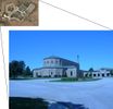
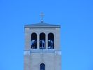
More interesting, perhaps, than the geohash itself was one of the landmarks I used: an eerily Pentagon-shaped building, which turned out to be part of a seminary. I took some pictures, which can be found below.


