Difference between revisions of "North Cascades National Park, Washington"
From Geohashing
imported>Thomcat (2008 - I was crazy.) |
imported>Thomcat (Add Robyn's Baker photo and expedition) |
||
| Line 11: | Line 11: | ||
|se = [[Wenatchee, Washington|Wenatchee]] | |se = [[Wenatchee, Washington|Wenatchee]] | ||
}} | }} | ||
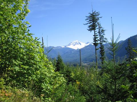
| + | [[Image:2008-09-13 48-121.baker.JPG|border]] | ||
'''Today's Location:''' | '''Today's Location:''' | ||
| Line 18: | Line 19: | ||
== Geohashes == | == Geohashes == | ||
| + | |||
| + | [[2008-09-13 48 -121]] -- Off a forestry service road near Maple Falls. | ||
[[2008-07-19 48 -121]] -- Just off the Mountain Loop Highway, near Granite Falls. | [[2008-07-19 48 -121]] -- Just off the Mountain Loop Highway, near Granite Falls. | ||
Revision as of 03:36, 15 September 2008
| Surrey, British Columbia | Chilliwack, British Columbia | Princeton, British Columbia |
| Bellingham | North Cascades National Park, Washington | Lake Chelan |
| Seattle | Snoqualmie | Wenatchee |
[[Category:Meetup in {{{lat}}} {{{lon}}}| ]]
Today's Location: [North Cascades National Park]
Mount Baker figures prominently in this mostly mountainous region. The National Park takes up a little less than one third of this graticule, which also contains towns of Darrington and Granite Falls. It is only crossed by one road, the North Cascades Highway.
Geohashes
2008-09-13 48 -121 -- Off a forestry service road near Maple Falls.
2008-07-19 48 -121 -- Just off the Mountain Loop Highway, near Granite Falls.
Local Geohashers
None yet!
