Difference between revisions of "2008-05-24 52 0"
From Geohashing
imported>Stephen Turner (links) |
imported>Thomcat (Success/failure category added) |
||
| Line 15: | Line 15: | ||
[[Image:HaverhillArt.JPG]] | [[Image:HaverhillArt.JPG]] | ||
| + | |||
| + | [[Category:Expeditions]] | ||
| + | [[Category:Expeditions with photos]] | ||
| + | [[Category:Coordinates reached]] | ||
Revision as of 05:37, 5 August 2008
| Sat 24 May 2008 in 52,0: 52.1266480, 0.5475331 geohashing.info google osm bing/os kml crox |
On the first Saturday of the project, the meetup point was located on the verge of the B1063, NE of Haverhill.
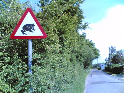
- Youpi was there (52.126648°, 0.547533°) this afternoon (Saturday, 24/5) between 16:00 and 16:30 but saw nobody :/ Anyway it was a cool 46 miles tour! On the way I spotted an unexpected road sign:
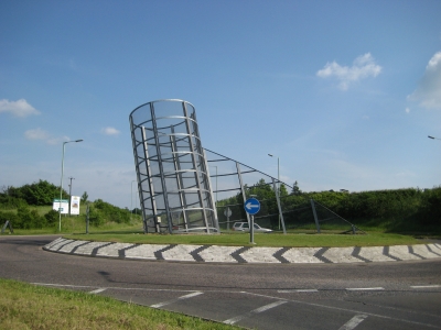
- Spanky went Saturday (24/5), leaving a little later than expected. Saw nobody and will be taking a satnav in future. Here is an Art found outside Haverhill:

