Difference between revisions of "2021-05-29 60 25"
From Geohashing
(→Expedition) |
(→Photos) |
||
| Line 21: | Line 21: | ||
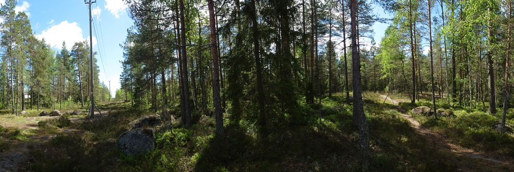
[[File:2021-05-29 60 25 05 Surroundings.jpg|1000px|Surroundings]] | [[File:2021-05-29 60 25 05 Surroundings.jpg|1000px|Surroundings]] | ||
<gallery> | <gallery> | ||
| − | 2021-05-29 60 25 01 place.jpg | In place | + | 2021-05-29 60 25 01 place.jpg | In the place |
2021-05-29 60 25 02 Site.jpg | The site of the Geohash | 2021-05-29 60 25 02 Site.jpg | The site of the Geohash | ||
2021-05-29 60 25 03 Proof.jpg | Proof | 2021-05-29 60 25 03 Proof.jpg | Proof | ||
| − | 2021-05-29 60 25 04 Geohash.jpg | The Geohash | + | 2021-05-29 60 25 04 Geohash.jpg | The Geohash and my cycling shoes |
</gallery> | </gallery> | ||
Revision as of 15:28, 29 May 2021
| Sat 29 May 2021 in Vantaa: 60.2756551, 25.1987215 geohashing.info google osm bing/os kml crox |
Location
This Geohash is located on a small hill in the woods near to knutersintie Landbo Helsinki
Participants
Expedition
The hashpoint was around 13 km from my home as the crow flies, but I cycled +20km to site, without the aid of gps and ended just ~ 5 meters apart from the geohash. I was in the right side of the path but the hashpoint was actually on the left shown in the panorama picture below.
As a preparation I have checked the location near the power line from the kansalaisen karttapaikka and measured the distance from the the mobile tower 80m.
Photos
Achievements
PPP earned the Land geohash achievement
|


