Difference between revisions of "2021-10-13 -38 146"
From Geohashing
Felix Dance (talk | contribs) (Described expedition) |
Felix Dance (talk | contribs) m |
||
| Line 17: | Line 17: | ||
== Photos == | == Photos == | ||
| − | [[File:Geohash 2021-10-13 -38 146 Matt.jpg|400px]] | + | [[File:Geohash 2021-10-13 -38 146 Matt.jpg|400px]] |
| − | |||
== Achievements == | == Achievements == | ||
{{#vardefine:ribbonwidth|800px}} | {{#vardefine:ribbonwidth|800px}} | ||
Revision as of 22:23, 13 October 2021
| Wed 13 Oct 2021 in -38,146: -38.1600415, 146.2312738 geohashing.info google osm bing/os kml crox |
Location
A paddock between the Princes Highway and the Bairnsdale Rail Line
Participants
Expedition
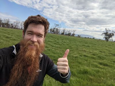
Matt noticed this geohash in the morning and went and got it during his 'Wellness Wednesday' workday.
It is not yet known which form of transport was used in attaining this hash.
