Difference between revisions of "2022-07-06 51 13"
(added achievements) |
|||
| Line 49: | Line 49: | ||
===tracklog=== | ===tracklog=== | ||
''will follow'' | ''will follow'' | ||
| + | |||
| + | == Achievements == | ||
| + | |||
| + | {{No_batteries_geohash | ||
| + | | latitude = 51 | ||
| + | | longitude = 13 | ||
| + | | date = 2022-07-06 | ||
| + | | name = Oisín | ||
| + | }} | ||
| + | {{OpenStreetMap achievement | ||
| + | |||
| + | | latitude = 51 | ||
| + | | longitude = 13 | ||
| + | | date = 2022-07-06 | ||
| + | | OSMlink = 123282408 | ||
| + | | OSMlink2 = 123282406 | ||
| + | | name = Oisín | ||
| + | }} | ||
[[Category:Expeditions]] | [[Category:Expeditions]] | ||
Revision as of 08:55, 7 July 2022
| Wed 6 Jul 2022 in 51,13: 51.0552340, 13.8048888 geohashing.info google osm bing/os kml crox |
Location
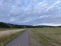
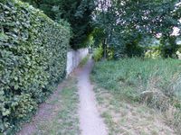
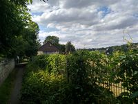
The hash is located on/next to a narrow foot path leading from the living quarter of Blasewitz with its beautiful villas down to the meadows along the river Elbe.
Country: Germany; state: Sachsen (Saxony, EU:DE:SN); district: Dresden; Stadtbezirk: Blasewitz; Stadtteil (city district): Blasewitz.
Plans
- Oisín planned to visit this. Due to work I did cancel my plans but my problems at work were solved a little faster than expected thus I took the detour on my way home and went to the hash.
Expedition
Danatar
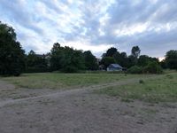
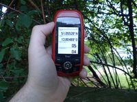
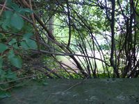
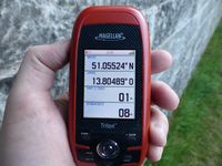
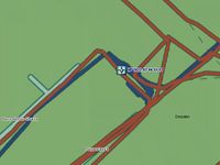
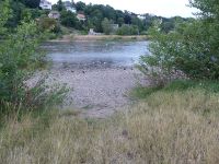
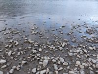
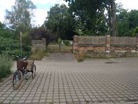
Almost half a year without any expedition, the algorithm hadn't been nice to me. But today I'm back, and even almost next door! After three hours of overtime (in German: wörk wörk wörk; translated: just another Wednesday) I took my bike and cycled along the Elbe cycle track. When I came near the 2020-08-05 51 13 location, I made a short detour. Due to the Elbe's currently low water level, the spot was dry this time. Then I continued towards today's spot. I found the path easily, between a dog school and the first houses of Blasewitz. "House" in this case means huge mansion. But the GPS wanted to put the exact spot on the other side of the garden wall. I walked to and fro, even onto the parking lot of another house, but I was still just a few meters from the spot. But after a while I managed to get within 1 meter while on the path, so I count this as coordinates reached. I took some pictures, then I cycled through Blasewitz and Striesen back home.
I have been on the path where the hashpoint is before, years ago when I visited every single street and path of Striesen and Blasewitz in preparation for possible déjà vu geohashes. The old tracklogs can be found here, making this a déjà vu geohash, hooray!
|
Oisín
When I noticed the coordinates I thought that it might be possible to visit the hash point after work. But unfortunately a problem turned up around 3 o'clock that needed to be solved immediately. As a consequence I canceled my plans here in the wiki. We managed to find a solution shortly before 5 o'clock thus I changed my plans again and cycled directly to the hash.
As planned, I arrived at the location without looking at my phone to qualify for the No Batteries Geohash achievement. Additionally I used the StreetComplete App to add details to Open Street Map Data of nearby houses to qualify for the OpenStreetMap achievement. As for the Déjà vu geohash achievement, I missed that by only a few meters: I never walked along this path before but I was very close as I visited the small roads to the east and west before to do some OSM mapping.
|
tracklog
will follow
Achievements
Oisín earned the No Batteries Geohash Achievement
|
Oisín earned the OpenStreetMap achievement
|
