Difference between revisions of "2023-04-29 42 -118"
From Geohashing
Michael5000 (talk | contribs) (→Expedition) |
Michael5000 (talk | contribs) |
||
| Line 18: | Line 18: | ||
*[[user:Michael5000|Michael5000]] | *[[user:Michael5000|Michael5000]] | ||
| − | |||
| − | |||
== Expedition == | == Expedition == | ||
| Line 26: | Line 24: | ||
[[2023-04-29 42 -117]] | [[2023-04-29 42 -117]] | ||
| − | |||
| − | |||
== Photos == | == Photos == | ||
| − | |||
| − | |||
| − | |||
<gallery perrow="5"> | <gallery perrow="5"> | ||
| − | </gallery> | + | File:2023-04-29 42 -118 1.jpg |
| + | File:2023-04-29 42 -118 2.jpg | ||
| + | File:2023-04-29 42 -118 3.jpg | ||
| + | File:2023-04-29 42 -118 6.jpg | ||
| + | File:2023-04-29 42 -118 5.jpg | ||
| + | File:2023-04-29 42 -118 8.jpg | ||
| + | File:2023-04-29 42 -118 9.jpg | ||
| + | File:2023-04-29 42 -118 11.jpg</gallery> | ||
== Achievements == | == Achievements == | ||
Revision as of 17:11, 30 April 2023
| Sat 29 Apr 2023 in 42,-118: 42.9242121, -118.0481861 geohashing.info google osm bing/os kml crox |
Location
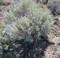
In sagebrush a mile and a half southwest from Highway 78.
Participants
Expedition
Photos
Achievements
Michael5000 earned the Multihash Achievement
|
Michael5000 earned the Consecutive geohash achievement
|
Michael5000 achieved level 6 of the Minesweeper Geohash achievement
|


