Difference between revisions of "2023-09-24 41 -72"
From Geohashing
(→Photos) |
(→Tracklog) |
||
| Line 27: | Line 27: | ||
== Tracklog == | == Tracklog == | ||
<!-- if your GPS device keeps a log, you may use Template:Tracklog, post a link here, or both --> | <!-- if your GPS device keeps a log, you may use Template:Tracklog, post a link here, or both --> | ||
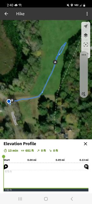
| + | [[File:Resized Screenshot 20230924 144007 Komoot.jpeg|thumb|Our path after parking according to MapMan's Komoot.]] | ||
== Photos == | == Photos == | ||
Revision as of 19:32, 24 September 2023
| Sun 24 Sep 2023 in 41,-72: 41.7718226, -72.1994730 geohashing.info google osm bing/os kml crox |
Location
In a field in Mansfield Center, CT.
Participants
JBest and MapMan
Plans
9/22: This hash is not at all far from where I work and where I live, so this might be really easy? Given the weather does not look phenomenal, I might be not dry by the end, or I might be going to the ren-fair in Lebanon for the day. We shall see how things turn out once the day arrives.
9/24: The rain lets up between 1 and 3 EDT, so MapMan and I will go sometime then after we eat lunch.
Expedition
Tracklog
Photos
I printed out a poster I found on the wiki...
Achievements


