Difference between revisions of "2023-12-15 -31 141"
From Geohashing
(Various more details, images, etc) |
|||
| Line 1: | Line 1: | ||
| − | + | [[File:-7399416133054358725.jpg|thumb|left]] | |
| − | + | {{meetup graticule | |
| − | |||
| − | |||
| − | |||
| − | |||
| − | |||
| − | |||
| lat=-31 | | lat=-31 | ||
| lon=141 | | lon=141 | ||
| date=2023-12-15 | | date=2023-12-15 | ||
| − | }} | + | }} |
== Location == | == Location == | ||
| − | About 500m south from the Barrier Highway (towards Adelaide) in some scrub land | + | About 500m south from the Barrier Highway (towards Adelaide) in some scrub land. |
== Participants == | == Participants == | ||
| Line 20: | Line 14: | ||
== Plans == | == Plans == | ||
| − | + | I haven't geohashed for many years and had since moved to the outback, where accessible geocaches are rare. Thought about caching a but and then about a week later saw an accessible spot. Called Johnny and we were set. | |
== Expedition == | == Expedition == | ||
| − | + | Walked for a fair while. At the hash point it looked almost like a small clearing along with a lone rock. | |
| − | + | Had a nice chat about various things. | |
| − | |||
| − | |||
== Photos == | == Photos == | ||
| − | |||
| − | |||
| − | |||
<gallery perrow="5"> | <gallery perrow="5"> | ||
| + | File:-7399416133054358725.jpg | Some feet | ||
</gallery> | </gallery> | ||
| Line 39: | Line 29: | ||
{{Virgin graticule | {{Virgin graticule | ||
| − | + | | latitude = -31 | |
| − | + | | longitude = 141 | |
| − | + | | date = 2023-12-15 | |
| − | + | | name = TheJosh | |
| − | + | | image = | |
}} | }} | ||
| Line 51: | Line 41: | ||
[[Category:Coordinates reached]] | [[Category:Coordinates reached]] | ||
| − | |||
| − | |||
| − | |||
| − | |||
| − | |||
| − | |||
| − | |||
| − | |||
| − | |||
| − | |||
| − | |||
| − | |||
| − | |||
| − | |||
| − | |||
| − | |||
| − | |||
| − | |||
| − | |||
| − | |||
| − | |||
| − | |||
| − | |||
| − | |||
| − | |||
| − | |||
| − | |||
| − | |||
| − | |||
| − | |||
| − | |||
| − | |||
| − | |||
| − | |||
| − | |||
| − | |||
| − | |||
| − | |||
| − | |||
| − | |||
| − | |||
| − | |||
{{location|AU|NSW|FW}} | {{location|AU|NSW|FW}} | ||
Revision as of 10:34, 29 December 2023

| Fri 15 Dec 2023 in -31,141: -31.9954193, 141.3396765 geohashing.info google osm bing/os kml crox |
Location
About 500m south from the Barrier Highway (towards Adelaide) in some scrub land.
Participants
Plans
I haven't geohashed for many years and had since moved to the outback, where accessible geocaches are rare. Thought about caching a but and then about a week later saw an accessible spot. Called Johnny and we were set.
Expedition
Walked for a fair while. At the hash point it looked almost like a small clearing along with a lone rock. Had a nice chat about various things.
Photos
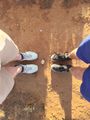
Some feet