Difference between revisions of "2024-02-10 32 35"
(Create Page) |
(→Tracklog: Add Tracklog) |
||
| Line 21: | Line 21: | ||
== Tracklog == | == Tracklog == | ||
| − | + | {{tracklog | 2024-02-10 32 35 Tracklog.gpx}} | |
== Photos == | == Photos == | ||
Revision as of 21:25, 10 February 2024
| Sat 10 Feb 2024 in 32,35: 32.7210372, 35.3353634 geohashing.info google osm bing/os kml crox |
Location
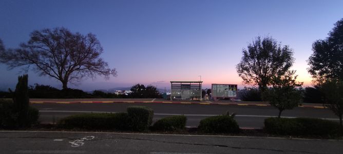
This Geohash is located near a bus station in Nof HaGalil.
Participants
Expedition
I took bus line 968 from Karmiel to Yiftahel Interchange. I thought I had a long wait until bus line 342 would arrive, but to my surprise, it was early - a rare occurrence in Israel. I got on it, and we were heading swiftly towards Nof HaGalil.
However, as soon as the bus entered Nof HaGalil, my GPS service got spoofed! According to it, I was at the Lebanese Air Transport, which is funny, considering it was over 120km away from my actual location at that time. This probably happened due to the IDF's interference with satellite navigation systems, in order to thwart drone and unmanned aircraft attacks by various terrorist organizations - at the time of this expedition, Israel was still in the middle of the Iron Swords War.
Despite being stripped naked of satellite navigation, I kept my composure, and got off the bus one stop before the stop near the Geohash, in order to make sure I don't get too far from it. Buses in Israel cannot be trusted - sometimes the drivers don't stop at stations because they don't feel like it, so I was better safe than sorry. After a quick reorientation, involving looking at Google Maps and reading nearby bus stop names, I started heading to the Geohash on foot. Sure enough, 5 minutes later, I was there! I had an easy time recognizing the location, because I was smart enough do some online scouting with Google Street View before heading out.
After restarting my phone, the GPS service worked fine again, and I made haste to get my proof, lest I be transported to Lebanon before being able to prove I made it to my first Geohash. I took some more pictures of the area, including a picture of Nof HaGalil's best bus stop (uncomfirmed). Then, I watched the pinky-blue sky turn dark as I was waiting for bus line 16. About 25 minutes later, plus 2 chilly human palms, the bus finally arrived and took me near Nazereth's central station. I couldn't allow myself to miss bus line 30 back to Karmiel, since the next one would arrive at 5:30, so I ran to its stop. Fortunately, the bus was waiting there, alongside its driver, who was confused while I was in such a hurry. A few minutes later, I got on the bus, and from there, it was smooth sailing back home.
Tracklog
Photos
Achievements
MetricSystemDude earned the Land geohash achievement
|
MetricSystemDude earned the Public transport geohash achievement
|
MetricSystemDude earned the Two to the N achievement
|
MetricSystemDude earned the Earliest geohasher achievement
|


