Difference between revisions of "2024-07-24 50 11"
(Story part 2) |
|||
| Line 33: | Line 33: | ||
|} | |} | ||
| − | |||
| + | About an hour after leaving the other geohash, I reached the ''Hermsdorfer Kreuz'' interchange and changed to the Autobahn A9, then took the first exit. A short drive along a country road, then I took a small side street (more like a field track) before parking the car. According to the map, there would be no direct track to the hashpoint from where I was, so I soon entered the forest. There was not much underbrush but a slope, so I had to walk carefully. After a while I crossed a tiny stream and found a small track which made it easier to get nearer to the spot. There was a fence on one side of that track and I was afraid I might not reach the spot, but the fenced-in area stopped soon. There were almost no bird sounds, which felt strange. When the track made a curve, I was not far from the spot, so I entered the forest again. In this place, the ground was covered in a thick layer of moss, making for an interesting experience of very soft ground. I saw 4 roe deer running away from the noise I made. During my hash dance I had to cross back and forth across the tiny stream, which was not a problem because it was really narrow. Finally I reached the spot, hooray number two! | ||
| + | |||
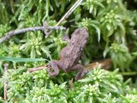
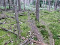
| + | I took the usual pictures. There were also some small frogs. On my way back to the car, I even found an easy trail that went mostly straight through the forest and ended not far from where I had parked. I continued on my way and got onto the A4 again at the Stadtroda exit. Due to all that meandering through the forest, it had taken me about one hour to get to the spot and back, even though the distance hadn't been that far. The [[2024-07-24 50 10|next hashpoint]] would be more easily accessible according to the map, although I wasn't sure whether it would be a no trespassing spot. | ||
{{gallery|width=200|height=200|lines=2 | {{gallery|width=200|height=200|lines=2 | ||
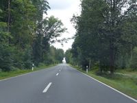
| − | |Image:2024-07-24_50_11_weg1.jpg|Along a | + | |Image:2024-07-24_50_11_weg1.jpg|Along a country road... |
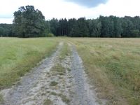
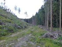
|Image:2024-07-24_50_11_weg2.jpg|...and a track... | |Image:2024-07-24_50_11_weg2.jpg|...and a track... | ||
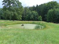
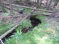
|Image:2024-07-24_50_11_teich.jpg|...past a pond... | |Image:2024-07-24_50_11_teich.jpg|...past a pond... | ||
| Line 54: | Line 56: | ||
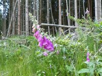
|Image:2024-07-24_50_11_fingerhut.jpg|foxglove | |Image:2024-07-24_50_11_fingerhut.jpg|foxglove | ||
|Image:2024-07-24_50_11_frosch.jpg|frog | |Image:2024-07-24_50_11_frosch.jpg|frog | ||
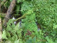
| − | |Image:2024-07-24_50_11_stammbruecke.jpg| | + | |Image:2024-07-24_50_11_stammbruecke.jpg|overgrown tree trunk making a tiny bridge |
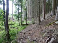
| − | |Image:2024-07-24_50_11_weg4.jpg| | + | |Image:2024-07-24_50_11_weg4.jpg|small trail |
}} | }} | ||
Revision as of 09:44, 28 July 2024
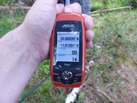
| Wed 24 Jul 2024 in Erfurt: 50.8600000, 11.8109109 geohashing.info google osm bing/os kml crox |
Location
Today's location is next to a tiny stream in the forest near Mörsdorf, not far from the Autobahnkreuz Hermsdorfer Kreuz.
Country: Germany; state: Thüringen (Thuringia, EU:DE:TH); district: Saale-Holzland-Kreis; municipality: Mörsdorf.
Weather: sunny with clouds
Expedition
Danatar
This expedition is the second part of an Ultra Hash (4 geohashes on the same day):
| 09 | 10 | 11 | 12 | |
|---|---|---|---|---|
| 50 | 4) 50 9 | 3) 50 10 | 2) 50 11 | 1) 50 12 |
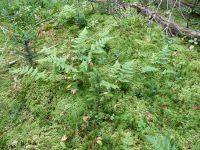
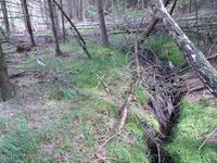
About an hour after leaving the other geohash, I reached the Hermsdorfer Kreuz interchange and changed to the Autobahn A9, then took the first exit. A short drive along a country road, then I took a small side street (more like a field track) before parking the car. According to the map, there would be no direct track to the hashpoint from where I was, so I soon entered the forest. There was not much underbrush but a slope, so I had to walk carefully. After a while I crossed a tiny stream and found a small track which made it easier to get nearer to the spot. There was a fence on one side of that track and I was afraid I might not reach the spot, but the fenced-in area stopped soon. There were almost no bird sounds, which felt strange. When the track made a curve, I was not far from the spot, so I entered the forest again. In this place, the ground was covered in a thick layer of moss, making for an interesting experience of very soft ground. I saw 4 roe deer running away from the noise I made. During my hash dance I had to cross back and forth across the tiny stream, which was not a problem because it was really narrow. Finally I reached the spot, hooray number two!
I took the usual pictures. There were also some small frogs. On my way back to the car, I even found an easy trail that went mostly straight through the forest and ended not far from where I had parked. I continued on my way and got onto the A4 again at the Stadtroda exit. Due to all that meandering through the forest, it had taken me about one hour to get to the spot and back, even though the distance hadn't been that far. The next hashpoint would be more easily accessible according to the map, although I wasn't sure whether it would be a no trespassing spot.
|
tracklog
File: willfollow.gpx does not exist. Reload?
