Difference between revisions of "2024-10-07 48 11"
From Geohashing
(→Photos) |
(→Photos) |
||
| Line 29: | Line 29: | ||
File:2024-10-07 48 11 proof 1.png | proof 1 | File:2024-10-07 48 11 proof 1.png | proof 1 | ||
File:2024-10-07 48 11 proof 2.png | proof 2 | File:2024-10-07 48 11 proof 2.png | proof 2 | ||
| − | File:2024-10-07 48 11 location 360.jpeg | | + | File:2024-10-07 48 11 location 360.jpeg | location |
File:2024-10-07 48 11 pretty view.jpeg | pretty view | File:2024-10-07 48 11 pretty view.jpeg | pretty view | ||
</gallery> | </gallery> | ||
Revision as of 16:37, 8 October 2024
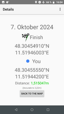
| Mon 7 Oct 2024 in 48,11: 48.3045491, 11.5194600 geohashing.info google osm bing/os kml crox |
Location
On a meadow close to Haimhausen
Participants
Expedition
Iqui: The location looked so unproblematic on the satellite photos, just a regular meadow with no strings attached. But turns out below the good looking grass, a muddy and wet ground was waiting for me. I tried to take a detour around the particularly wet spots, but that only made things worse as more distance needed to be traversed. The overall area the hash was located in was surprisingly beautiful though, and on my way back, I got some good views of the alps!
Feyi:
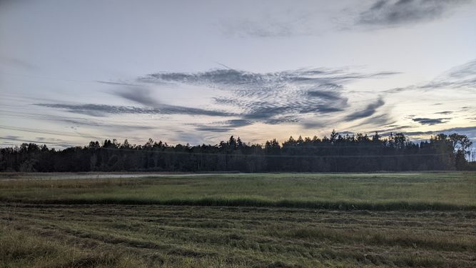
- Zu dieser Zeit sammelten sich schon die Nebelschwaden am Boden und machten diese etwas abgelegene Wiese zu einem beinahe verwunschenen Ort (s. Bild 1, Stelle des Geohashes).
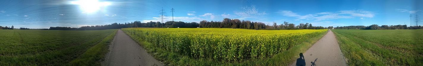
- Unweit des Geohashes auf dem Radweg hatte man einen schönen Blick in Richtung Alpen. Links der Baumgruppe ist mit geübtem Auge auch der Münchner Olympiaturm zu entdecken (s. Bild 2).
Photos
Feyi:
Location

View to Alps and Munich


Iqui:

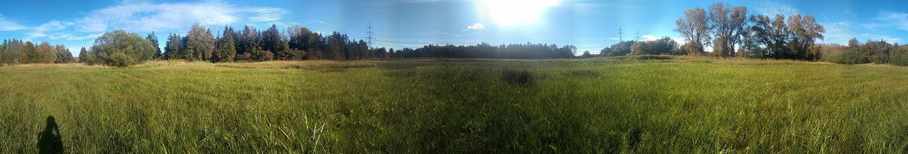
me at location

proof 1
proof 2
location
pretty view


Achievements
the achievement below this text is outdated :) (to be removed)
Feyi earned the Last man standing achievement
|