Difference between revisions of "Category:GNSS receivers"
From Geohashing
(cat description) |
m (dedup 'useful') |
||
| Line 1: | Line 1: | ||
| − | These are photos of various [[wikipedia:en:satellite navigation#Global_navigation_satellite_systems|GNSS]] receivers. Typically these are also photos of proof, although they also are | + | These are photos of various [[wikipedia:en:satellite navigation#Global_navigation_satellite_systems|GNSS]] receivers. Typically these are also photos of proof, although they also are handy to identify which models are useful for hashing, their upsides and downsides (by reading the reports where they are used, and identifying the image uploaders as people with personal experience with them). |
[[category:technology]] | [[category:technology]] | ||
[[category:galleries by topic]] | [[category:galleries by topic]] | ||
Latest revision as of 03:27, 22 September 2020
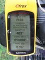
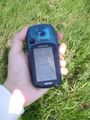
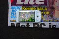
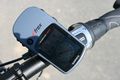
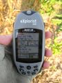
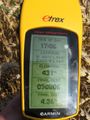
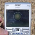
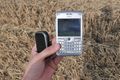
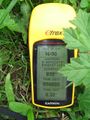
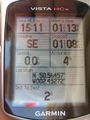
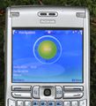
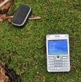
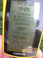
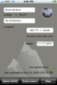
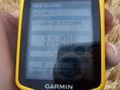
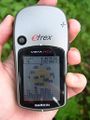
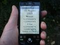
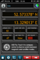
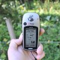
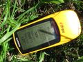
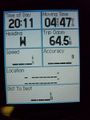
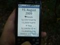
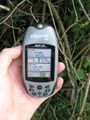
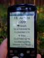
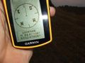
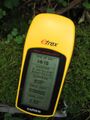
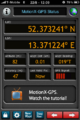
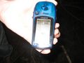
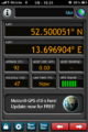
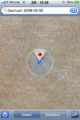
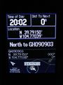
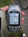
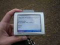
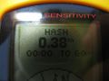
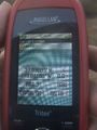
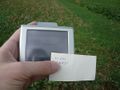
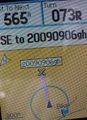
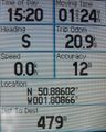
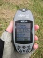
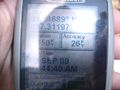
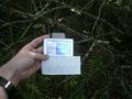
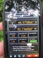
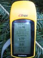
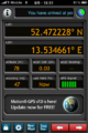
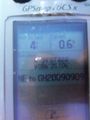
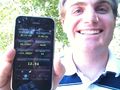
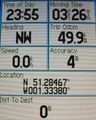
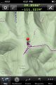
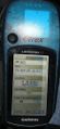
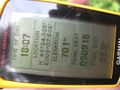
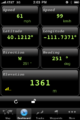
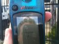
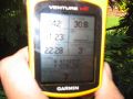
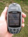
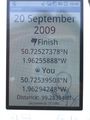
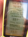
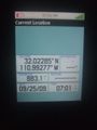
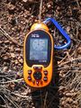
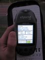
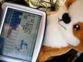
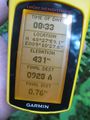
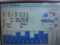
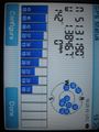
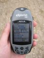
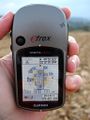
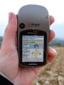
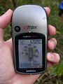
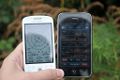
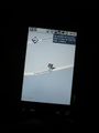
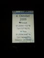
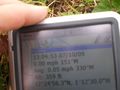
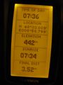
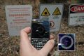
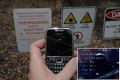
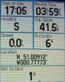
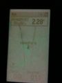
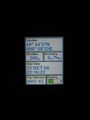
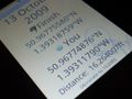
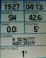
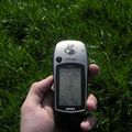
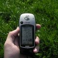
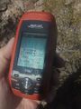
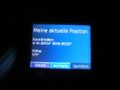
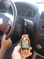
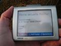
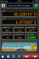
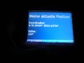
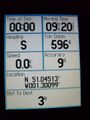
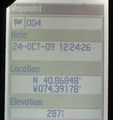
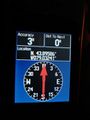
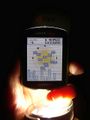
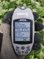
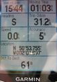
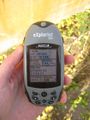
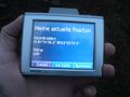
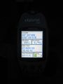
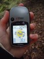
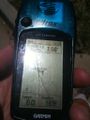
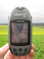
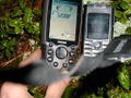
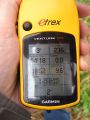
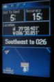
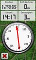
These are photos of various GNSS receivers. Typically these are also photos of proof, although they also are handy to identify which models are useful for hashing, their upsides and downsides (by reading the reports where they are used, and identifying the image uploaders as people with personal experience with them).
Subcategories
This category has the following 2 subcategories, out of 2 total.
Media in category "GNSS receivers"
The following 200 files are in this category, out of 2,166 total.
(previous page) (next page)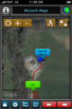 2009-08-02 39 -84.GPSTrack.png 320 × 480; 192 KB
 2009-08-02 48 9 GPS.jpg 612 × 816; 88 KB
 2009-08-02 49 -114 soClose.jpg 600 × 800; 311 KB
 2009-08-04 51 -0 newspaper MITO.jpg 4,290 × 2,856; 3.27 MB
 2009-08-04 51 8 2.jpg 875 × 584; 272 KB
 2009-08-05 49 10 gps.jpg 420 × 560; 89 KB
 2009-08-06 48 8 GPS.jpg 490 × 653; 63 KB
 2009-08-08 46 6 03-reached.jpg 800 × 800; 139 KB
 2009-08-08 46 6 04-coordinates.jpg 800 × 531; 149 KB
 2009-08-08 48 8 GPS.jpg 480 × 640; 65 KB
 2009-08-08 50 -2 Macronencer 02.jpg 540 × 720; 90 KB
 2009-08-09 46 6 02-reached.jpg 850 × 939; 136 KB
 2009-08-09 46 6 03-coordinates.jpg 850 × 867; 220 KB
 2009-08-09 48 9 GPS.jpg 480 × 640; 48 KB
 2009-08-10 39 -86 GPS.png 320 × 480; 56 KB
 2009-08-10 45 -123-GPS.jpg 1,656 × 1,242; 509 KB
 2009-08-12 48 12 dawidi gps.jpg 384 × 513; 69 KB
 2009-08-13 52 13 P1040581.JPG 2,816 × 2,112; 2.18 MB
 2009-08-13 52 13-IMG 0144.PNG 320 × 480; 133 KB
 2009-08-15 46 6 18-coordinates reached.jpg 800 × 800; 94 KB
 2009-08-15 48 9 GPS.jpg 640 × 480; 75 KB
 2009-08-15 50 -1 Macronencer 48.jpg 540 × 720; 91 KB
 2009-08-15 52 13 P1040587.JPG 2,816 × 2,112; 2.16 MB
 2009-08-16 55 12 gps.JPG 958 × 1,277; 334 KB
 2009-08-18 52 13 DSCF1374.JPG 615 × 820; 260 KB
 2009-08-21 54 12 coordinate.JPG 1,024 × 768; 93 KB
 2009-08-22 48 8 GPS.jpg 480 × 640; 49 KB
 2009-08-22 52 13 IMG 0152.PNG 320 × 480; 137 KB
 2009-08-22 52 13 IMG 0153.PNG 320 × 480; 190 KB
 2009-08-22 52 13 P1040603.JPG 845 × 634; 105 KB
 2009-08-22 gps.jpg 800 × 1,200; 843 KB
 2009-08-23 42 -85 GPS.png 320 × 480; 56 KB
 2009-08-23 44 -85 GPS.png 320 × 480; 58 KB
 2009-08-23 44 -86 GPS.png 320 × 480; 57 KB
 2009-08-23 50 12 gps.jpg 384 × 512; 110 KB
 2009-08-26 46 6 01-coordinates reached.jpg 700 × 700; 140 KB
 2009-08-26 48 9 GPS.jpg 480 × 640; 61 KB
 2009-08-26 52 13 P1040664.JPG 845 × 634; 89 KB
 2009-08-26 52 13 P1040665.JPG 845 × 634; 80 KB
 2009-08-26 52 13 P1040666.JPG 845 × 634; 77 KB
 2009-08-26 52 13 P1040667.JPG 845 × 634; 77 KB
 2009-08-26 52 13 P1040668.JPG 845 × 634; 80 KB
 2009-08-27 54 10 gps.jpg 600 × 800; 130 KB
 2009-08-27 54 9 gps.jpg 480 × 641; 103 KB
 2009-08-28 40 -105 gps.JPG 384 × 512; 39 KB
 2009-08-28 42 -84 GPS.png 320 × 480; 55 KB
 2009-08-28 49 10 gps.jpg 684 × 912; 94 KB
 2009-08-28 50 11 gps.JPG 684 × 912; 57 KB
 2009-08-28 51 11 gps.JPG 684 × 912; 67 KB
 2009-08-28 52 -0 GPS.jpg 3,072 × 2,304; 1.6 MB
 2009-08-28 52 12 gps.JPG 684 × 912; 65 KB
 2009-08-29 48 9 e GPS.jpg 480 × 640; 43 KB
 2009-08-29 52 13 gps.JPG 684 × 912; 79 KB
 2009-08-30 50 10 gps.JPG 528 × 704; 32 KB
 2009-08-30 50 11 gps.JPG 528 × 704; 84 KB
 2009-08-30 50 12 gps.JPG 684 × 912; 131 KB
 2009-08-30 51 12 gps.JPG 684 × 912; 135 KB
 2009-08-30 51 13 gps.JPG 684 × 912; 138 KB
 2009-08-31 39 -104 gps.JPG 512 × 683; 71 KB
 2009-08-31 45 -122-Here.jpg 1,656 × 1,242; 256 KB
 2009-08-31 45 -122-Zeros.jpg 1,656 × 1,242; 288 KB
 2009-09-01 49 -123 IMG 2083.JPG 800 × 600; 146 KB
 2009-09-01 52 13 IMG 0248.PNG 320 × 480; 140 KB
 2009-09-02 50 -2 Macronencer 02.jpg 540 × 720; 52 KB
 2009-09-02 52 13 IMG 0277.PNG 320 × 480; 243 KB
 2009-09-03 39 -104 gps.JPG 512 × 683; 57 KB
 2009-09-03 49 10 gps.JPG 423 × 564; 45 KB
 2009-09-04 50 10 gps.jpg 600 × 450; 77 KB
 2009-09-05 -36 174 IMG 1985 -800x600-.jpg 800 × 600; 71 KB
 2009-09-05 31 -110 gps.jpg 444 × 592; 70 KB
 2009-09-06 49 9 gps.jpg 600 × 450; 72 KB
 2009-09-06 50 -1 Macronencer 14.jpg 520 × 720; 148 KB
 2009-09-06 50 -1 Macronencer 16.jpg 576 × 720; 137 KB
 2009-09-06 51 14 gps.JPG 423 × 564; 47 KB
 2009-09-07 31 -97a.JPG 3,264 × 2,448; 2.79 MB
 2009-09-07 50 10 gps.jpg 1,000 × 750; 186 KB
 2009-09-08 44 -92reached.jpg 240 × 320; 23 KB
 2009-09-08 48 8 GPS.jpg 480 × 640; 65 KB
 2009-09-08 52 13 IMG 0314.PNG 320 × 480; 142 KB
 2009-09-09 39 -86 proof.jpg 960 × 1,280; 229 KB
 2009-09-09 40 -111 Toothy Grin.jpg 2,048 × 1,536; 982 KB
 2009-09-10 51 -1 Macronencer 01.jpg 577 × 720; 121 KB
 2009-09-10 51 -1 Macronencer 02.jpg 560 × 720; 114 KB
 2009-09-12 48 9 GPS.jpg 480 × 640; 79 KB
 2009-09-13 50 -1 Macronencer 03.jpg 540 × 720; 91 KB
 2009-09-14 42 -84 GPS.PNG 320 × 480; 55 KB
 2009-09-14 50 9 gps pi.JPG 423 × 564; 42 KB
 2009-09-15 39 -111 track2.jpg 320 × 480; 27 KB
 2009-09-15 40 -74 coordinates1.jpg 232 × 500; 29 KB
 2009-09-15 48 9 GPS.jpg 640 × 480; 72 KB
 2009-09-17 40 -111 SpeedRacer.png 320 × 480; 50 KB
 2009-09-17 42 -70 gps.jpg 1,477 × 1,373; 268 KB
 2009-09-17 49 10 gps.jpg 600 × 450; 74 KB
 2009-09-18 48 11 gps.jpg 384 × 482; 82 KB
 2009-09-20 -37 144 mdb 0002.jpg 768 × 1,024; 90 KB
 2009-09-20 -37 144 mdb 0004.jpg 1,024 × 768; 90 KB
 2009-09-20 47 -121.gps.jpg 480 × 360; 40 KB
 2009-09-20 49 9 gps.JPG 423 × 564; 41 KB
 2009-09-20 50 -1 3429.JPG 1,536 × 2,048; 1.02 MB
 2009-09-21 46 5 05-reached1.jpg 480 × 723; 107 KB
 2009-09-21 46 5 06-reached2.jpg 480 × 723; 122 KB
 2009-09-22 48 8 GPS.jpg 480 × 640; 63 KB
 2009-09-22 52 -0 GPS.jpg 3,072 × 2,304; 1.68 MB
 2009-09-25 32 -110 gps.jpg 480 × 640; 49 KB
 2009-09-25 35 -107 - GPS.jpg 2,304 × 3,072; 2.6 MB
 2009-09-27 48 2 gps.jpg 528 × 704; 44 KB
 2009-09-27 50 -1 IMG 1646.JPG 1,536 × 1,152; 201 KB
 2009-09-27 50 -1 Macronencer 02.jpg 540 × 720; 102 KB
 2009-09-27 50 -120 arrival.jpg 642 × 768; 162 KB
 2009-09-27 52 13 IMG 0445.JPG 2,736 × 3,648; 2.07 MB
 2009-09-27 53 14 IMG 0455.JPG 2,736 × 3,648; 2.08 MB
 2009-09-28 48 9 GPS.jpg 480 × 640; 57 KB
 2009-09-29 51 -0 IMG 1683.JPG 1,536 × 1,152; 618 KB
 2009-09-29 51 -1 IMG 1752.JPG 1,152 × 1,536; 580 KB
 2009-09-29 51 -1 Macronencer 02.jpg 720 × 540; 21 KB
 2009-09-30 52 -0 gps.JPG 528 × 704; 29 KB
 2009-10-01 51 -0 IMG 1802.JPG 1,152 × 1,536; 618 KB
 2009-10-02 51 -0 gps.JPG 528 × 704; 55 KB
 2009-10-02 51 -0 Macronencer 03.jpg 540 × 720; 78 KB
 2009-10-02 52 -0 GPS.jpg 3,072 × 2,304; 1.6 MB
 2009-10-03 51 -1 gps.JPG 528 × 704; 49 KB
 2009-10-04 49 12 gps loctime.jpg 383 × 512; 65 KB
 2009-10-04 49 12 gps sunrise.jpg 383 × 512; 53 KB
 2009-10-04 49 13 gps.jpg 479 × 640; 94 KB
 2009-10-04 51 -1 JonRead 1.jpg 1,024 × 680; 71 KB
 2009-10-04 51 7 517 2.JPG 528 × 704; 32 KB
 2009-10-04 51 7 517.JPG 528 × 704; 35 KB
 2009-10-06 -37 145 mdb 001.jpg 768 × 1,024; 48 KB
 2009-10-06 43 -79 C.JPG 300 × 400; 54 KB
 2009-10-06 49 10 gps.jpg 600 × 450; 69 KB
 2009-10-07 38 -9 IMG 1837.JPG 1,152 × 1,536; 409 KB
 2009-10-07 48 9 GPS.jpg 480 × 640; 63 KB
 2009-10-07 52 -1 GPS.jpg 3,072 × 2,304; 1.53 MB
 2009-10-09 48 8 GPS 736.jpg 450 × 600; 33 KB
 2009-10-10 -19 146 01.jpg 602 × 400; 82 KB
 2009-10-10 -19 146 02.jpg 602 × 400; 74 KB
 2009-10-10 32 -111 gps.jpg 480 × 640; 75 KB
 2009-10-10 41 -72 gps.jpg 1,941 × 3,009; 408 KB
 2009-10-10 41 -74 so close.jpg 480 × 640; 72 KB
 2009-10-10 42 -83 Aerial View.PNG 320 × 480; 313 KB
 2009-10-10 42 -83 GPS.PNG 320 × 480; 55 KB
 2009-10-11 -37 144 mdb 002.jpg 768 × 1,024; 58 KB
 2009-10-11 32 -110 gps.jpg 480 × 640; 87 KB
 2009-10-11 51 -0 Macronencer 10.jpg 575 × 720; 130 KB
 2009-10-12 -37 144 mdb 001.jpg 768 × 1,024; 52 KB
 2009-10-12 -37 144 mdb 002.jpg 768 × 1,024; 68 KB
 2009-10-12 49 9 gps.JPG 528 × 704; 26 KB
 2009-10-13 -37 145 mdb 003.jpg 768 × 1,024; 47 KB
 2009-10-13 50 -1 3714.JPG 1,024 × 768; 587 KB
 2009-10-13 50 -1 Macronencer 02.jpg 570 × 720; 147 KB
 2009-10-14 47 8 01-reached1.jpg 800 × 800; 133 KB
 2009-10-14 47 8 02-reached2.jpg 800 × 800; 132 KB
 2009-10-16 32 -111 gps.jpg 480 × 640; 82 KB
 2009-10-16 49 9 gps.jpg 600 × 450; 50 KB
 2009-10-17 35 -106 - GPS.jpg 2,304 × 3,072; 2.31 MB
 2009-10-17 49 8 gps.jpg 600 × 450; 70 KB
 2009-10-17 50 6 03.PNG 320 × 480; 143 KB
 2009-10-18 49 9 gps.jpg 600 × 450; 44 KB
 2009-10-18 51 -2 Macronencer 03.jpg 540 × 720; 85 KB
 2009-10-19 49 12 dawidi.jpg 800 × 600; 64 KB
 2009-10-19 49 12 gps.jpg 480 × 640; 49 KB
 2009-10-19 50 10 gps.jpg 600 × 450; 49 KB
 2009-10-23 51 -1 Macronencer 04.jpg 540 × 720; 77 KB
 2009-10-24 40 -74 coordinates.jpg 400 × 424; 24 KB
 2009-10-24 50 -1 3901.JPG 1,024 × 1,365; 237 KB
 2009-10-25 -33 18 phone coords.jpg 3,022 × 2,709; 994 KB
 2009-10-27 49 11 gps.jpg 384 × 488; 90 KB
 2009-10-29 52 -0 GPS.jpg 3,072 × 2,304; 1.63 MB
 2009-10-30 33 -106 - GPS.jpg 3,072 × 2,304; 2.86 MB
 2009-10-31 43 -79 C.jpg 300 × 400; 48 KB
 2009-10-31 48 12 gps.jpg 480 × 641; 69 KB
 2009-10-31 49 10 gps.JPG 528 × 704; 69 KB
 2009-10-31 50 -2 Macronencer 04.jpg 505 × 720; 107 KB
 2009-11-01 43 -79 A.jpg 300 × 400; 47 KB
 2009-11-01 45 -123 apr 08.jpg 768 × 1,024; 210 KB
 2009-11-01 45 6 06-reached1.jpg 767 × 640; 112 KB
 2009-11-01 45 6 07-reached2.jpg 767 × 640; 118 KB
 2009-11-01 48 10 gps.JPG 528 × 704; 55 KB
 2009-11-01 49 10 d gps.jpg 600 × 450; 66 KB
 2009-11-01 49 10 gps.JPG 528 × 704; 26 KB
 2009-11-02 43 -79 A.jpg 300 × 400; 33 KB
 2009-11-06 35 -108 - GPS.jpg 2,304 × 3,072; 3.15 MB
 2009-11-07 35 -106 - GPS.jpg 3,072 × 2,304; 2.78 MB
 2009-11-07 46 -123 apr 01.jpg 1,024 × 1,365; 326 KB
 2009-11-07 48 7 e GPS.jpg 480 × 640; 72 KB
 2009-11-07 49 11 gps.jpg 450 × 600; 115 KB
 2009-11-08 -37 144 mbd 001.jpg 768 × 1,024; 195 KB
 2009-11-08 48 8 gps.JPG 528 × 704; 43 KB
 2009-11-10 49 10 poop.JPG 704 × 528; 23 KB
 2009-11-14 60 16 gps.jpg 1,024 × 768; 148 KB
 2009-11-18 35 -78.gps.jpg 360 × 480; 41 KB
 2009-11-19 39 -86 Proof.jpg 496 × 750; 43 KB
 2009-11-21 49 11 GPSr.jpg 240 × 400; 66 KB
 2009-11-23 35 -106 - GPS.JPG 600 × 800; 143 KB
 2009-11-23 48 9 GPS.jpg 480 × 640; 70 KB
 2009-11-23 51 -1 GPS.jpg 3,072 × 2,304; 1.66 MB
 2009-11-26 49 9 after.JPG 704 × 528; 72 KB
 2009-11-26 49 9 before.JPG 704 × 528; 76 KB
 2009-11-26 49 9 gps.JPG 528 × 704; 66 KB
 2009-11-27 37 -122 Success.jpg 638 × 640; 111 KB


