Difference between revisions of "2008-08-26 45 -75"
From Geohashing
imported>Logopolis (Reverting, edited wrong page) |
imported>Jiml m (Think the date was really the 26th) |
||
| Line 1: | Line 1: | ||
{{meetup graticule | {{meetup graticule | ||
| − | |||
| lat=44 | | lat=44 | ||
| lon=-76 | | lon=-76 | ||
| − | | date=2009-08- | + | | date=2009-08-26 |
| − | |||
| − | |||
}} | }} | ||
Revision as of 18:18, 5 September 2009
| Wed 26 Aug 2009 in 44,-76: 44.6147963, -76.1615897 geohashing.info google osm bing/os kml crox |
Expedition by Wojciech Kozlowski
Today's meetup was in a cornfield off Timm Drive, near Bells Corners -- quite convenient for a few of us from Kanata to visit during lunch. After a brief debate about whether or not to hop the fence and get closer to the geohash... we decided to hop the fence and get closer to the geohash. To our surprise, the geohash point was already somewhat trampled. Previous geohashers, maybe? Or maybe just wild cornfield partiers? We may never know...
Gallery
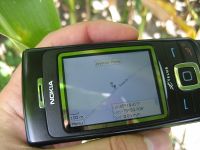
The geohash location, on my trusty cell phone.
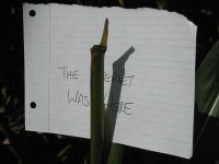
We left a sign to any who might follow: The internet was here!
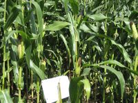
A slightly trampled cornfield. (Not by us!)
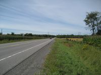
Timm Drive. Lots of nothing...

From left to right: Wikky (whom we dragged along), Paul, and me.


