Difference between revisions of "2009-01-22 40 -105"
From Geohashing
imported>Hoozer (→Pictures) |
imported>Hoozer |
||
| Line 6: | Line 6: | ||
| date=2009-01-22 | | date=2009-01-22 | ||
}} | }} | ||
| + | == About == | ||
| + | |||
The NW [[Denver, Colorado|Denver]] geohash for January 22nd, 2009 was located on Stove Prairie Road off of CO 14, near Mishawaka and Roosevelt National Park. | The NW [[Denver, Colorado|Denver]] geohash for January 22nd, 2009 was located on Stove Prairie Road off of CO 14, near Mishawaka and Roosevelt National Park. | ||
| + | |||
| + | == Expeditions == | ||
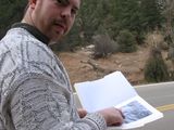
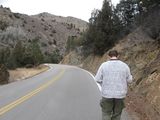
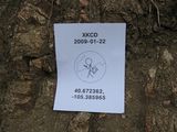
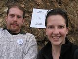
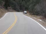
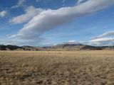
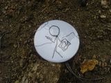
After starting at CSU, we drove up CO 14 and arrived at the site at 2:30pm. There was a pull off about 500 feet up the road from the site itself with a small trail that leads up one of the hills. We walked back down the road to take pictures and left a small white XKCD button on the rock outcropping on the east side of the road to mark the site. We then walked back to the car and wandered up the trail a little ways, but determined we didn't have enough time to make the entire trek. We then took Rist Canyon Road back down to Fort Collins - a beautiful drive! | After starting at CSU, we drove up CO 14 and arrived at the site at 2:30pm. There was a pull off about 500 feet up the road from the site itself with a small trail that leads up one of the hills. We walked back down the road to take pictures and left a small white XKCD button on the rock outcropping on the east side of the road to mark the site. We then walked back to the car and wandered up the trail a little ways, but determined we didn't have enough time to make the entire trek. We then took Rist Canyon Road back down to Fort Collins - a beautiful drive! | ||
Revision as of 01:24, 23 January 2009
| Thu 22 Jan 2009 in 40,-105: 40.6723626, -105.3859647 geohashing.info google osm bing/os kml crox |
About
The NW Denver geohash for January 22nd, 2009 was located on Stove Prairie Road off of CO 14, near Mishawaka and Roosevelt National Park.
Expeditions
After starting at CSU, we drove up CO 14 and arrived at the site at 2:30pm. There was a pull off about 500 feet up the road from the site itself with a small trail that leads up one of the hills. We walked back down the road to take pictures and left a small white XKCD button on the rock outcropping on the east side of the road to mark the site. We then walked back to the car and wandered up the trail a little ways, but determined we didn't have enough time to make the entire trek. We then took Rist Canyon Road back down to Fort Collins - a beautiful drive!

