Difference between revisions of "2009-02-13 49 8"
imported>Relet (yay! hashcard!) |
imported>FippeBot m (Location) |
||
| Line 43: | Line 43: | ||
[[Category:Coordinates reached]] | [[Category:Coordinates reached]] | ||
[[Category:Expeditions with photos]] | [[Category:Expeditions with photos]] | ||
| + | {{location|DE|BW|HD}} | ||
Latest revision as of 01:50, 8 August 2019
| Fri 13 Feb 2009 in Mannheim: 49.4542140, 8.6897951 geohashing.info google osm bing/os kml crox |
Expedition
ilpadre
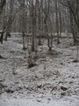
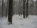
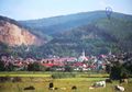
The hashpoint was near the top of a mountain (at 325 m, with the top being at 327 m) near Dossenheim. I cycled 7 km from Heidelberg and had to deal with heavy snowfall as I walked on hiking trails. The side of the mountain was steep, but I still reached the top relatively easy, though there were no paths leading directly to it. I had to walk 250 m off the trails and came to a spot that seemed to be the highest elevation around. Aerial images indicated that the hashpoint was near a group of cypress trees. Without a GPS I couldn't find the exact point, but everything looked pretty much the same anyway, so I declared a spot near two cypresses to be the hashpoint.
Parking
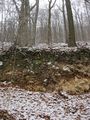
No shortcut here
Neither here
Tyre tracks leading towards the hashpoint
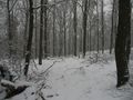
No more tracks, still lots of snow
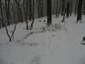
Boars?
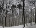
Cypresses
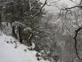
Later: Overlooking Dossenheim


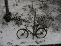
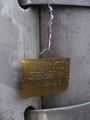
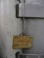
Revisiting my first hashpoint: On the way back, I came by the spot of my first expedition. It was great to see my hashtag still hanging there.
Then
Now


Hashcard
Back
Front

