Difference between revisions of "2009-02-14 -37 145"
imported>MykaDragonBlue m (→myka: the tale) |
imported>MykaDragonBlue m (→Photos: myka's photos) |
||
| Line 39: | Line 39: | ||
== Photos == | == Photos == | ||
| + | ==== Myka's Photos ==== | ||
| + | <gallery perrow="3"> | ||
| + | Image:2009-02-14_-37_145_mdb_007.jpg|Getting blindified on the bridge was not so fun. | ||
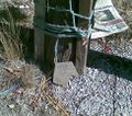
| + | Image:2009-02-14_-37_145_mdb_001.jpg|Someone had been there... | ||
| + | Image:2009-02-14_-37_145_mdb_002.jpg|I left my own token. | ||
| + | Image:2009-02-14_-37_145 mdb 003.jpg|The paths trough the sanctuary | ||
| + | Image:2009-02-14_-37_145_mdb_004.jpg|Yay, a lake with ducks. | ||
| + | Image:2009-02-14_-37_145_mdb_005.jpg|Artists trail. Beware artists? | ||
| + | Image:2009-02-14_-37_145_mdb_006.jpg|I found the rest of the bike paths on the way back. | ||
| + | </gallery> | ||
| + | |||
| + | |||
[[Category:Expeditions]] | [[Category:Expeditions]] | ||
| + | [[Category:Expeditions with photos]] | ||
| + | [[Category:Coordinates reached]] | ||
Revision as of 12:07, 14 February 2009
| Sat 14 Feb 2009 in -37,145: -37.8253397, 145.1710255 geohashing.info google osm bing/os kml crox |
The Place
Central Road, Nunawading
Who is going
Stephen
It's not far from home, so am going to ride over.
myka
The exercise will do me good and the sanctuary nearby might be worth a look, but I'll be a little late.
The Tale
Set out at about 3:30, knowing i would be later than 4pm.
It was a 20km ride to the hash point, generally uneventful, and not too bad. I will however re-iterate my desire to get some sun glasses for riding with. I managed to get some sort of still alive flying-ant thing in my eye while crossing a slim bridge in traffic. Being unable to see properly due to something crawling on your eyeball in that situation was not the most wonderful experience of my life, I must admit.
Also, I discovered that there are heaps of good bike paths (shared use with walkers / joggers, but still) going at least half as far as I wanted to go, but then they headed off in another direction.
The unfortunate part is that I didn't discover some sections until the return journey. While the paths were good, the signage pointing them out wasn't so much.
I arrived as close to the hash as possible (It was actually located in someones backyard) at about 5:15. somewhat longer than I'd expected, but then the closest I had got to trip planning was to look at google maps, and use my highly technical 'memory' method of navigating. It actually worked really well, with me only needing to re-check once i was within range of the 'Image I took earlier' on my phone.
I found a mark in front off the house where the hash was, and left my own as well. But really, It was just some house on a suburban street, so i didn't stay long.
Instead I rode through some of the paths in the nearby Blackburn Lake Sanctuary. It was pleasant enough, and probably a bit therapeutic, since I haven't bee able to get out of the city for a few weeks. there was a lake, and ducks, and apparently one needs to watch out for wild artists roaming the area in packs (at least historically)
Uneventful trip back, although I got more stuff in my eyes, and found the rest of the bike paths.


