Difference between revisions of "2009-03-08 -33 150"
From Geohashing
imported>CJ (Created expedition page) |
imported>CJ (Added photos (finally!)) |
||
| Line 30: | Line 30: | ||
==Photos== | ==Photos== | ||
| − | + | <gallery> | |
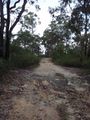
| − | + | Image:CJ_092.JPG|The fire-trail into the bush | |
| − | Image: | + | Image:CJ_093.JPG|The point at which we left the fire-trail |
| − | Image: | + | Image:CJ_094.JPG|Watties entering the bush |
| − | Image: | + | Image:CJ_095.JPG|Hashpoint in the distance |
| − | Image: | + | Image:CJ_096.JPG|Descending towards the creek |
| − | </gallery> | + | Image:CJ_097.JPG|The rock ledge we came across |
| + | Image:CJ_098.JPG|The rock ledge from below | ||
| + | Image:CJ_099.JPG|Large fallen tree which helped us find the right point | ||
| + | Image:CJ_100.JPG|CJ and Watties at the hashpoint | ||
| + | Image:CJ_101.JPG|We left our mark | ||
| + | Image:CJ_102.JPG|The raptors got to Watties | ||
| + | Image:CJ_103.JPG|Looking back to where we had come from | ||
| + | Image:CJ_104.JPG|The fence we followed to get back out | ||
| + | </gallery> | ||
| + | |||
Revision as of 00:10, 10 April 2009
| Sun 8 Mar 2009 in -33,150: -33.5792666, 150.9768719 geohashing.info google osm bing/os kml crox |
Contents
Location
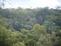
This geohash was located in some bushland off Neichs Rd near the suburb of Hillside in Sydney's north. It looked like it would be quite a nice walk through the bush to get to the location.
Attendees
CJ & Watties earned the Land geohash achievement
|
Report
Coming soon
Photos
The fire-trail into the bush
The point at which we left the fire-trail
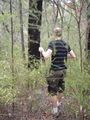
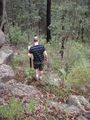
Watties entering the bush
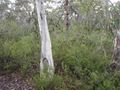
Hashpoint in the distance
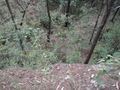
Descending towards the creek
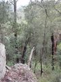
The rock ledge we came across
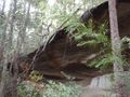
The rock ledge from below
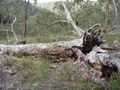
Large fallen tree which helped us find the right point
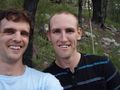
CJ and Watties at the hashpoint
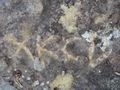
We left our mark
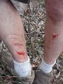
The raptors got to Watties
Looking back to where we had come from

The fence we followed to get back out


