Difference between revisions of "2009-03-26 48 9"
From Geohashing
imported>Dawidi (+ meetup template) |
imported>Ekorren (Gallery up, report follows) |
||
| Line 6: | Line 6: | ||
}} | }} | ||
| − | Ekorren | + | == About == |
| + | |||
| + | The hash is located at the margin of the residential area ''Bästenhardt'' in the town of ''Mössingen''. | ||
| + | |||
| + | == Expedition by [[User:Ekorren|Ekorren]] == | ||
| + | |||
| + | tbd. | ||
| + | |||
| + | == Gallery == | ||
| + | |||
| + | <gallery> | ||
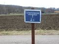
| + | Image:2009-03-26 48 9 HashPath.jpg|Near Hash | ||
| + | Image:2009-03-26 48 9 HashTree.jpg|Hash Tree | ||
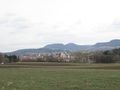
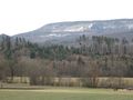
| + | Image:2009-03-26 48 9 HashView.jpg|View from hash | ||
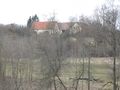
| + | Image:2009-03-26 48 9 HashTown.jpg|View on Mössingen | ||
| + | Image:2009-03-26 48 9 Erdrutsch.jpg|The Mössingen landslide | ||
| + | Image:2009-03-26 48 9 Schwefelwasser.jpg|Pipe for sulfur water below the road. | ||
| + | Image:2009-03-26 48 9 GPS.jpg|''yawn'' | ||
| + | </gallery> | ||
[[Category:Expeditions]] | [[Category:Expeditions]] | ||
[[Category:Coordinates reached]] | [[Category:Coordinates reached]] | ||
Revision as of 10:41, 30 March 2009
| Thu 26 Mar 2009 in 48,9: 48.4016096, 9.0211529 geohashing.info google osm bing/os kml crox |
About
The hash is located at the margin of the residential area Bästenhardt in the town of Mössingen.
Expedition by Ekorren
tbd.
Gallery
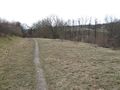
Near Hash
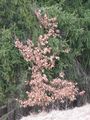
Hash Tree
View from hash
View on Mössingen
The Mössingen landslide
Pipe for sulfur water below the road.
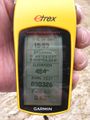
yawn


