Difference between revisions of "2009-04-18 51 10"
imported>Reinhard m |
imported>Reinhard m (code) |
||
| Line 5: | Line 5: | ||
| date=2009-04-18 | | date=2009-04-18 | ||
}} | }} | ||
| + | == Participants == | ||
| + | * [[user:Manu|Manu]] | ||
| + | * [[user:Reinhard|Reinhard]] | ||
| + | == Expedition == | ||
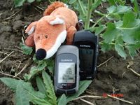
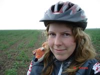
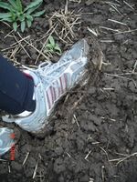
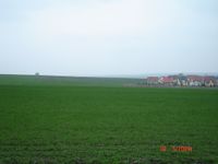
As we were at one that this would be our last consecutive geohash for the present, [[user:Reinhard|Reinhard]] and me decided to repeat the [[2009-04-13_51_10|Easter Monday's trip]] to Dachwig where the hash point coincidentally was located again. Unfortunately this time the wheather wasn't as good: it was cold outside and as it had rained in the morning everything was wet. Nevertheless we could bring ourselves to go by bike and soon enjoyed our ride on the long and hilly way there. Therefore we reached Dachwig not until 4 pm, but I'm sure nobody else had attended the meetup anyway. With the help of topographic maps on the GPS device we tried to find the road which was nearest to the geo hash, so we got as close at 700 meters and then Reinhard gave up as he did not want to walk over the really muddy ground. Contrary to him I did not want to capitulate after we got so far! So I left Reinhard with the bikes and walked on the direct way to the hash point - see the photos to understand how exhausting this was. Finally I reached the coordinates and took some photos before I hurried back to Reinhard who was already freezing - his fingers had turned white! Other 25 km lay ahead, but despite effeteness and drizzle we got home after altogether four hours where we were faced with an evening of cleaning our clothes, shoes and bikes. | As we were at one that this would be our last consecutive geohash for the present, [[user:Reinhard|Reinhard]] and me decided to repeat the [[2009-04-13_51_10|Easter Monday's trip]] to Dachwig where the hash point coincidentally was located again. Unfortunately this time the wheather wasn't as good: it was cold outside and as it had rained in the morning everything was wet. Nevertheless we could bring ourselves to go by bike and soon enjoyed our ride on the long and hilly way there. Therefore we reached Dachwig not until 4 pm, but I'm sure nobody else had attended the meetup anyway. With the help of topographic maps on the GPS device we tried to find the road which was nearest to the geo hash, so we got as close at 700 meters and then Reinhard gave up as he did not want to walk over the really muddy ground. Contrary to him I did not want to capitulate after we got so far! So I left Reinhard with the bikes and walked on the direct way to the hash point - see the photos to understand how exhausting this was. Finally I reached the coordinates and took some photos before I hurried back to Reinhard who was already freezing - his fingers had turned white! Other 25 km lay ahead, but despite effeteness and drizzle we got home after altogether four hours where we were faced with an evening of cleaning our clothes, shoes and bikes. | ||
Revision as of 13:00, 11 April 2012
| Sat 18 Apr 2009 in 51,10: 51.0845888, 10.8377370 geohashing.info google osm bing/os kml crox |
Participants
Expedition
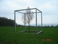
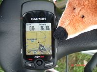
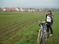
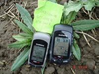
As we were at one that this would be our last consecutive geohash for the present, Reinhard and me decided to repeat the Easter Monday's trip to Dachwig where the hash point coincidentally was located again. Unfortunately this time the wheather wasn't as good: it was cold outside and as it had rained in the morning everything was wet. Nevertheless we could bring ourselves to go by bike and soon enjoyed our ride on the long and hilly way there. Therefore we reached Dachwig not until 4 pm, but I'm sure nobody else had attended the meetup anyway. With the help of topographic maps on the GPS device we tried to find the road which was nearest to the geo hash, so we got as close at 700 meters and then Reinhard gave up as he did not want to walk over the really muddy ground. Contrary to him I did not want to capitulate after we got so far! So I left Reinhard with the bikes and walked on the direct way to the hash point - see the photos to understand how exhausting this was. Finally I reached the coordinates and took some photos before I hurried back to Reinhard who was already freezing - his fingers had turned white! Other 25 km lay ahead, but despite effeteness and drizzle we got home after altogether four hours where we were faced with an evening of cleaning our clothes, shoes and bikes.
---Manu
- Photo Gallery
Awards
Manu and Reinhard earned the Bicycle geohash achievement
|
Manu earned the Consecutive geohash achievement
|
